You are here: Home > Network List > US - United States National Seismic Network Stations List
> Station AMTX Amarillo, Texas, USA > Earthquake Result Viewer
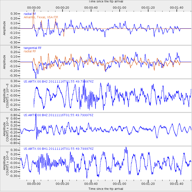
AMTX Amarillo, Texas, USA - Earthquake Result Viewer
*The percent match for this event was below the threshold and hence no stack was calculated.
| Earthquake location: |
Tonga Islands |
| Earthquake latitude/longitude: |
-17.5/-173.7 |
| Earthquake time(UTC): |
2011/11/16 (320) 01:43:45 GMT |
| Earthquake Depth: |
39 km |
| Earthquake Magnitude: |
5.5 MB |
| Earthquake Catalog/Contributor: |
NEIC PDE/NEIC PDE-M |
|
| Network: |
US United States National Seismic Network |
| Station: |
AMTX Amarillo, Texas, USA |
| Lat/Lon: |
34.53 N/101.41 W |
| Elevation: |
1010 m |
|
| Distance: |
85.9 deg |
| Az: |
52.036 deg |
| Baz: |
245.703 deg |
| Ray Param: |
$rayparam |
*The percent match for this event was below the threshold and hence was not used in the summary stack. |
|
| Radial Match: |
67.671455 % |
| Radial Bump: |
400 |
| Transverse Match: |
48.325367 % |
| Transverse Bump: |
400 |
| SOD ConfigId: |
558545 |
| Insert Time: |
2013-09-19 06:35:59.258 +0000 |
| GWidth: |
2.5 |
| Max Bumps: |
400 |
| Tol: |
0.001 |
|
Signal To Noise
| Channel | StoN | STA | LTA |
| US:AMTX:00:BHZ:20111116T01:55:49.799976Z | 2.2931066 | 2.883543E-7 | 1.2574831E-7 |
| US:AMTX:00:BH1:20111116T01:55:49.799976Z | 0.687734 | 8.7455646E-8 | 1.2716494E-7 |
| US:AMTX:00:BH2:20111116T01:55:49.799976Z | 1.0048226 | 1.3064374E-7 | 1.3001673E-7 |
| Arrivals |
| Ps | |
| PpPs | |
| PsPs/PpSs | |


