You are here: Home > Network List > US - United States National Seismic Network Stations List
> Station ERPA Erie, Pennsylvania, USA > Earthquake Result Viewer
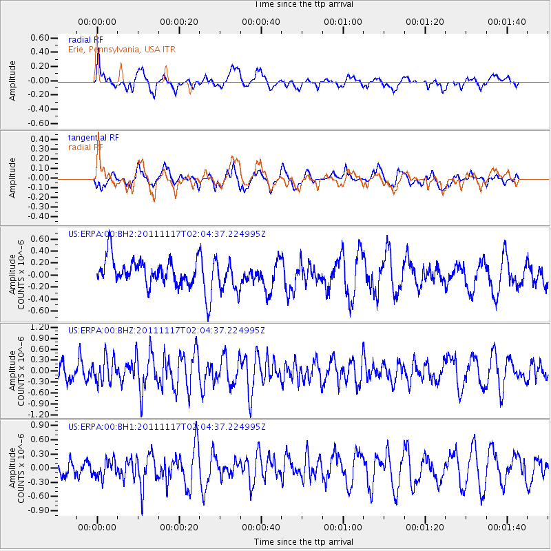
ERPA Erie, Pennsylvania, USA - Earthquake Result Viewer
*The percent match for this event was below the threshold and hence no stack was calculated.
| Earthquake location: |
Off Coast Of Ecuador |
| Earthquake latitude/longitude: |
-1.7/-81.5 |
| Earthquake time(UTC): |
2011/11/17 (321) 01:57:05 GMT |
| Earthquake Depth: |
27 km |
| Earthquake Magnitude: |
5.7 MB, 5.6 MS, 6.0 MW, 5.9 MW |
| Earthquake Catalog/Contributor: |
WHDF/NEIC |
|
| Network: |
US United States National Seismic Network |
| Station: |
ERPA Erie, Pennsylvania, USA |
| Lat/Lon: |
42.12 N/79.99 W |
| Elevation: |
306 m |
|
| Distance: |
43.6 deg |
| Az: |
1.678 deg |
| Baz: |
182.255 deg |
| Ray Param: |
$rayparam |
*The percent match for this event was below the threshold and hence was not used in the summary stack. |
|
| Radial Match: |
65.03485 % |
| Radial Bump: |
400 |
| Transverse Match: |
43.629787 % |
| Transverse Bump: |
400 |
| SOD ConfigId: |
558545 |
| Insert Time: |
2013-09-19 06:39:28.782 +0000 |
| GWidth: |
2.5 |
| Max Bumps: |
400 |
| Tol: |
0.001 |
|
Signal To Noise
| Channel | StoN | STA | LTA |
| US:ERPA:00:BHZ:20111117T02:04:37.224995Z | 1.4837521 | 3.4049773E-7 | 2.2948423E-7 |
| US:ERPA:00:BH1:20111117T02:04:37.224995Z | 1.0270962 | 1.8963665E-7 | 1.8463379E-7 |
| US:ERPA:00:BH2:20111117T02:04:37.224995Z | 1.298506 | 2.5975612E-7 | 2.000423E-7 |
| Arrivals |
| Ps | |
| PpPs | |
| PsPs/PpSs | |


