You are here: Home > Network List > IU - Global Seismograph Network (GSN - IRIS/USGS) Stations List
> Station HNR Honiara, Solomon Islands > Earthquake Result Viewer
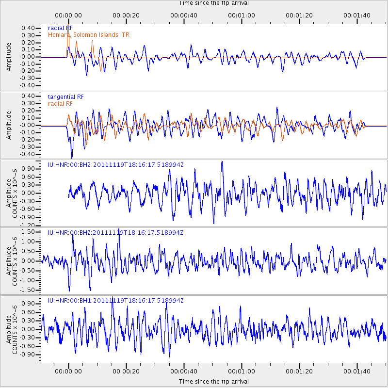
HNR Honiara, Solomon Islands - Earthquake Result Viewer
*The percent match for this event was below the threshold and hence no stack was calculated.
| Earthquake location: |
Andreanof Islands, Aleutian Is. |
| Earthquake latitude/longitude: |
53.1/-174.1 |
| Earthquake time(UTC): |
2011/11/19 (323) 18:06:24 GMT |
| Earthquake Depth: |
215 km |
| Earthquake Magnitude: |
5.5 MW, 5.6 MW |
| Earthquake Catalog/Contributor: |
NEIC PDE/NEIC PDE-M |
|
| Network: |
IU Global Seismograph Network (GSN - IRIS/USGS) |
| Station: |
HNR Honiara, Solomon Islands |
| Lat/Lon: |
9.44 S/159.95 E |
| Elevation: |
100 m |
|
| Distance: |
66.1 deg |
| Az: |
208.136 deg |
| Baz: |
16.737 deg |
| Ray Param: |
$rayparam |
*The percent match for this event was below the threshold and hence was not used in the summary stack. |
|
| Radial Match: |
58.886868 % |
| Radial Bump: |
400 |
| Transverse Match: |
65.640656 % |
| Transverse Bump: |
400 |
| SOD ConfigId: |
558545 |
| Insert Time: |
2013-09-19 06:52:44.294 +0000 |
| GWidth: |
2.5 |
| Max Bumps: |
400 |
| Tol: |
0.001 |
|
Signal To Noise
| Channel | StoN | STA | LTA |
| IU:HNR:00:BHZ:20111119T18:16:17.518994Z | 2.452001 | 6.265222E-7 | 2.5551466E-7 |
| IU:HNR:00:BH1:20111119T18:16:17.518994Z | 1.3899909 | 3.566846E-7 | 2.566093E-7 |
| IU:HNR:00:BH2:20111119T18:16:17.518994Z | 1.302922 | 3.224965E-7 | 2.475179E-7 |
| Arrivals |
| Ps | |
| PpPs | |
| PsPs/PpSs | |


