You are here: Home > Network List > US - United States National Seismic Network Stations List
> Station HAWA Hanford, Washington, USA > Earthquake Result Viewer
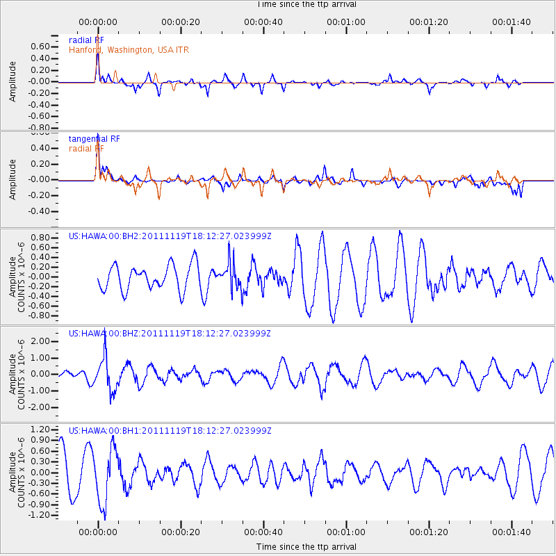
HAWA Hanford, Washington, USA - Earthquake Result Viewer
*The percent match for this event was below the threshold and hence no stack was calculated.
| Earthquake location: |
Andreanof Islands, Aleutian Is. |
| Earthquake latitude/longitude: |
53.1/-174.1 |
| Earthquake time(UTC): |
2011/11/19 (323) 18:06:24 GMT |
| Earthquake Depth: |
215 km |
| Earthquake Magnitude: |
5.5 MW, 5.6 MW |
| Earthquake Catalog/Contributor: |
NEIC PDE/NEIC PDE-M |
|
| Network: |
US United States National Seismic Network |
| Station: |
HAWA Hanford, Washington, USA |
| Lat/Lon: |
46.39 N/119.53 W |
| Elevation: |
364 m |
|
| Distance: |
35.2 deg |
| Az: |
78.489 deg |
| Baz: |
301.459 deg |
| Ray Param: |
$rayparam |
*The percent match for this event was below the threshold and hence was not used in the summary stack. |
|
| Radial Match: |
53.57858 % |
| Radial Bump: |
375 |
| Transverse Match: |
50.628094 % |
| Transverse Bump: |
400 |
| SOD ConfigId: |
558545 |
| Insert Time: |
2013-09-19 06:53:48.219 +0000 |
| GWidth: |
2.5 |
| Max Bumps: |
400 |
| Tol: |
0.001 |
|
Signal To Noise
| Channel | StoN | STA | LTA |
| US:HAWA:00:BHZ:20111119T18:12:27.023999Z | 3.5558686 | 1.0208877E-6 | 2.870994E-7 |
| US:HAWA:00:BH1:20111119T18:12:27.023999Z | 1.4937251 | 7.60007E-7 | 5.087998E-7 |
| US:HAWA:00:BH2:20111119T18:12:27.023999Z | 1.0626001 | 2.678129E-7 | 2.5203545E-7 |
| Arrivals |
| Ps | |
| PpPs | |
| PsPs/PpSs | |


