You are here: Home > Network List > IU - Global Seismograph Network (GSN - IRIS/USGS) Stations List
> Station MAKZ Makanchi, Kazakhstan > Earthquake Result Viewer
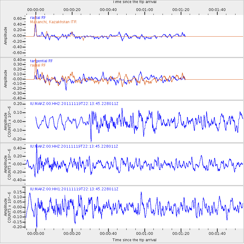
MAKZ Makanchi, Kazakhstan - Earthquake Result Viewer
*The percent match for this event was below the threshold and hence no stack was calculated.
| Earthquake location: |
Kuril Islands |
| Earthquake latitude/longitude: |
46.6/151.5 |
| Earthquake time(UTC): |
2011/11/19 (323) 22:06:00 GMT |
| Earthquake Depth: |
96 km |
| Earthquake Magnitude: |
5.5 MB |
| Earthquake Catalog/Contributor: |
NEIC PDE/NEIC PDE-M |
|
| Network: |
IU Global Seismograph Network (GSN - IRIS/USGS) |
| Station: |
MAKZ Makanchi, Kazakhstan |
| Lat/Lon: |
46.81 N/81.98 E |
| Elevation: |
600 m |
|
| Distance: |
46.2 deg |
| Az: |
296.931 deg |
| Baz: |
63.459 deg |
| Ray Param: |
$rayparam |
*The percent match for this event was below the threshold and hence was not used in the summary stack. |
|
| Radial Match: |
46.903736 % |
| Radial Bump: |
400 |
| Transverse Match: |
49.149166 % |
| Transverse Bump: |
400 |
| SOD ConfigId: |
558545 |
| Insert Time: |
2013-09-19 06:56:16.532 +0000 |
| GWidth: |
2.5 |
| Max Bumps: |
400 |
| Tol: |
0.001 |
|
Signal To Noise
| Channel | StoN | STA | LTA |
| IU:MAKZ:00:HHZ:20111119T22:13:45.228011Z | 3.080763 | 1.7710317E-7 | 5.748679E-8 |
| IU:MAKZ:00:HH1:20111119T22:13:45.228011Z | 1.7546738 | 6.280213E-8 | 3.579134E-8 |
| IU:MAKZ:00:HH2:20111119T22:13:45.228011Z | 1.8603463 | 8.34922E-8 | 4.4879926E-8 |
| Arrivals |
| Ps | |
| PpPs | |
| PsPs/PpSs | |


