You are here: Home > Network List > US - United States National Seismic Network Stations List
> Station WUAZ Wupatki, Arizona, USA > Earthquake Result Viewer
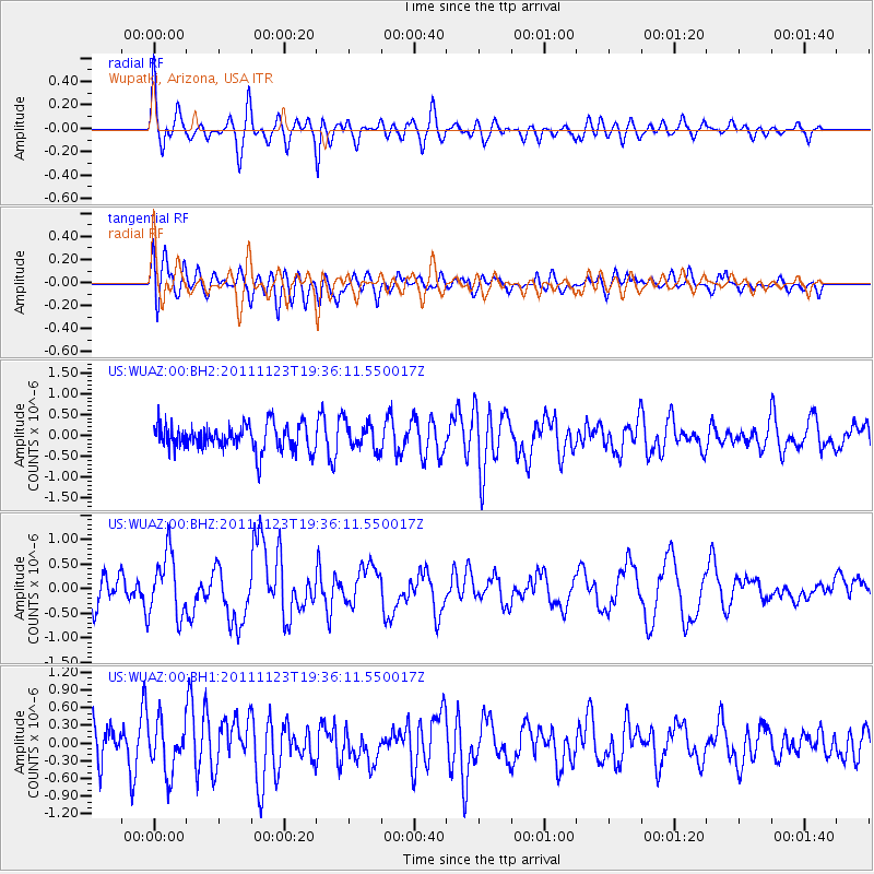
WUAZ Wupatki, Arizona, USA - Earthquake Result Viewer
*The percent match for this event was below the threshold and hence no stack was calculated.
| Earthquake location: |
Near East Coast Of Honshu, Japan |
| Earthquake latitude/longitude: |
37.4/141.4 |
| Earthquake time(UTC): |
2011/11/23 (327) 19:24:31 GMT |
| Earthquake Depth: |
34 km |
| Earthquake Magnitude: |
5.7 MB, 5.8 MS, 6.1 MW, 6.1 MW |
| Earthquake Catalog/Contributor: |
WHDF/NEIC |
|
| Network: |
US United States National Seismic Network |
| Station: |
WUAZ Wupatki, Arizona, USA |
| Lat/Lon: |
35.52 N/111.37 W |
| Elevation: |
1592 m |
|
| Distance: |
81.0 deg |
| Az: |
52.073 deg |
| Baz: |
309.611 deg |
| Ray Param: |
$rayparam |
*The percent match for this event was below the threshold and hence was not used in the summary stack. |
|
| Radial Match: |
61.93413 % |
| Radial Bump: |
400 |
| Transverse Match: |
59.224083 % |
| Transverse Bump: |
400 |
| SOD ConfigId: |
558545 |
| Insert Time: |
2013-09-19 07:14:11.191 +0000 |
| GWidth: |
2.5 |
| Max Bumps: |
400 |
| Tol: |
0.001 |
|
Signal To Noise
| Channel | StoN | STA | LTA |
| US:WUAZ:00:BHZ:20111123T19:36:11.550017Z | 2.4620366 | 6.369104E-7 | 2.586925E-7 |
| US:WUAZ:00:BH1:20111123T19:36:11.550017Z | 1.272805 | 4.1955633E-7 | 3.2963126E-7 |
| US:WUAZ:00:BH2:20111123T19:36:11.550017Z | 1.0594974 | 3.240881E-7 | 3.0588853E-7 |
| Arrivals |
| Ps | |
| PpPs | |
| PsPs/PpSs | |


