You are here: Home > Network List > IU - Global Seismograph Network (GSN - IRIS/USGS) Stations List
> Station JOHN Johnston Island, USA > Earthquake Result Viewer
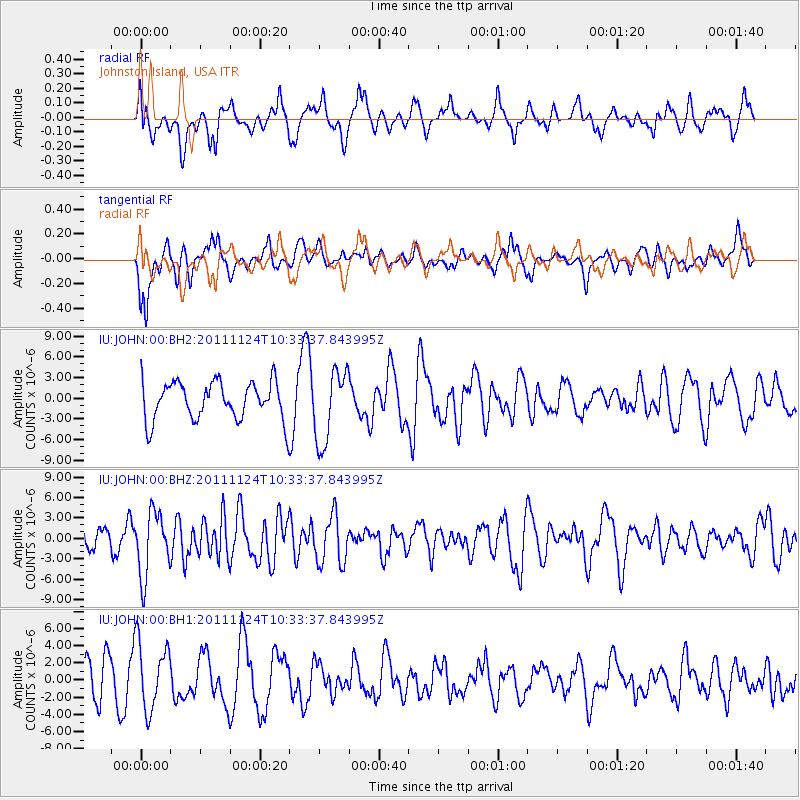
JOHN Johnston Island, USA - Earthquake Result Viewer
*The percent match for this event was below the threshold and hence no stack was calculated.
| Earthquake location: |
Hokkaido, Japan Region |
| Earthquake latitude/longitude: |
41.9/142.6 |
| Earthquake time(UTC): |
2011/11/24 (328) 10:25:34 GMT |
| Earthquake Depth: |
38 km |
| Earthquake Magnitude: |
5.9 MB, 5.8 MS, 6.2 MW, 6.2 MW |
| Earthquake Catalog/Contributor: |
WHDF/NEIC |
|
| Network: |
IU Global Seismograph Network (GSN - IRIS/USGS) |
| Station: |
JOHN Johnston Island, USA |
| Lat/Lon: |
16.73 N/169.53 W |
| Elevation: |
2.0 m |
|
| Distance: |
47.9 deg |
| Az: |
106.794 deg |
| Baz: |
311.763 deg |
| Ray Param: |
$rayparam |
*The percent match for this event was below the threshold and hence was not used in the summary stack. |
|
| Radial Match: |
51.252174 % |
| Radial Bump: |
400 |
| Transverse Match: |
41.020714 % |
| Transverse Bump: |
400 |
| SOD ConfigId: |
558545 |
| Insert Time: |
2013-09-19 07:16:36.078 +0000 |
| GWidth: |
2.5 |
| Max Bumps: |
400 |
| Tol: |
0.001 |
|
Signal To Noise
| Channel | StoN | STA | LTA |
| IU:JOHN:00:BHZ:20111124T10:33:37.843995Z | 3.4278932 | 4.7331114E-6 | 1.3807639E-6 |
| IU:JOHN:00:BH1:20111124T10:33:37.843995Z | 1.3976517 | 3.9289575E-6 | 2.8111135E-6 |
| IU:JOHN:00:BH2:20111124T10:33:37.843995Z | 1.9135568 | 5.2934033E-6 | 2.766264E-6 |
| Arrivals |
| Ps | |
| PpPs | |
| PsPs/PpSs | |


