You are here: Home > Network List > IU - Global Seismograph Network (GSN - IRIS/USGS) Stations List
> Station HNR Honiara, Solomon Islands > Earthquake Result Viewer
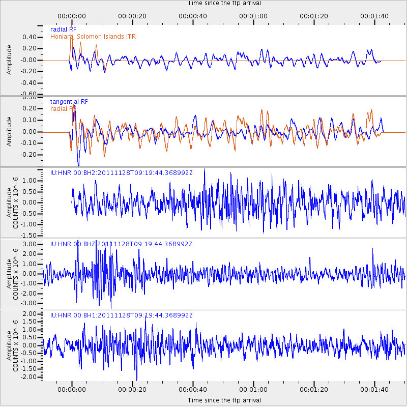
HNR Honiara, Solomon Islands - Earthquake Result Viewer
*The percent match for this event was below the threshold and hence no stack was calculated.
| Earthquake location: |
Bali Sea |
| Earthquake latitude/longitude: |
-7.0/117.0 |
| Earthquake time(UTC): |
2011/11/28 (332) 09:13:11 GMT |
| Earthquake Depth: |
616 km |
| Earthquake Magnitude: |
5.9 MB, 5.8 MW, 5.8 MW |
| Earthquake Catalog/Contributor: |
WHDF/NEIC |
|
| Network: |
IU Global Seismograph Network (GSN - IRIS/USGS) |
| Station: |
HNR Honiara, Solomon Islands |
| Lat/Lon: |
9.44 S/159.95 E |
| Elevation: |
100 m |
|
| Distance: |
42.6 deg |
| Az: |
96.286 deg |
| Baz: |
269.879 deg |
| Ray Param: |
$rayparam |
*The percent match for this event was below the threshold and hence was not used in the summary stack. |
|
| Radial Match: |
48.28202 % |
| Radial Bump: |
400 |
| Transverse Match: |
48.239635 % |
| Transverse Bump: |
400 |
| SOD ConfigId: |
558545 |
| Insert Time: |
2013-09-19 07:23:16.302 +0000 |
| GWidth: |
2.5 |
| Max Bumps: |
400 |
| Tol: |
0.001 |
|
Signal To Noise
| Channel | StoN | STA | LTA |
| IU:HNR:00:BHZ:20111128T09:19:44.368992Z | 2.0937052 | 1.0553215E-6 | 5.040449E-7 |
| IU:HNR:00:BH1:20111128T09:19:44.368992Z | 1.5154876 | 5.2461877E-7 | 3.461716E-7 |
| IU:HNR:00:BH2:20111128T09:19:44.368992Z | 0.9548118 | 3.3724967E-7 | 3.5321062E-7 |
| Arrivals |
| Ps | |
| PpPs | |
| PsPs/PpSs | |


