You are here: Home > Network List > IU - Global Seismograph Network (GSN - IRIS/USGS) Stations List
> Station KIP Kipapa, Hawaii, USA > Earthquake Result Viewer
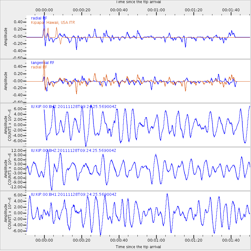
KIP Kipapa, Hawaii, USA - Earthquake Result Viewer
*The percent match for this event was below the threshold and hence no stack was calculated.
| Earthquake location: |
Bali Sea |
| Earthquake latitude/longitude: |
-7.0/117.0 |
| Earthquake time(UTC): |
2011/11/28 (332) 09:13:11 GMT |
| Earthquake Depth: |
616 km |
| Earthquake Magnitude: |
5.9 MB, 5.8 MW, 5.8 MW |
| Earthquake Catalog/Contributor: |
WHDF/NEIC |
|
| Network: |
IU Global Seismograph Network (GSN - IRIS/USGS) |
| Station: |
KIP Kipapa, Hawaii, USA |
| Lat/Lon: |
21.42 N/158.01 W |
| Elevation: |
110 m |
|
| Distance: |
87.9 deg |
| Az: |
68.254 deg |
| Baz: |
261.687 deg |
| Ray Param: |
$rayparam |
*The percent match for this event was below the threshold and hence was not used in the summary stack. |
|
| Radial Match: |
66.76039 % |
| Radial Bump: |
400 |
| Transverse Match: |
56.216183 % |
| Transverse Bump: |
400 |
| SOD ConfigId: |
558545 |
| Insert Time: |
2013-09-19 07:23:19.733 +0000 |
| GWidth: |
2.5 |
| Max Bumps: |
400 |
| Tol: |
0.001 |
|
Signal To Noise
| Channel | StoN | STA | LTA |
| IU:KIP:00:BHZ:20111128T09:24:25.569004Z | 2.0887372 | 8.190189E-6 | 3.92112E-6 |
| IU:KIP:00:BH1:20111128T09:24:25.569004Z | 0.51104295 | 1.554583E-6 | 3.0419812E-6 |
| IU:KIP:00:BH2:20111128T09:24:25.569004Z | 0.7514897 | 2.778373E-6 | 3.697154E-6 |
| Arrivals |
| Ps | |
| PpPs | |
| PsPs/PpSs | |


