OTAV Otavalo, Ecuador - Earthquake Result Viewer
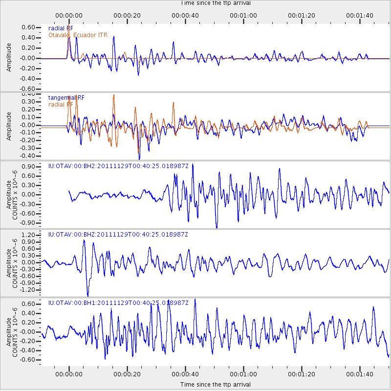
Earthquake location: North Of Ascension Island
Earthquake latitude/longitude: -1.6/-15.4
Earthquake time(UTC): 2011/11/29 (333) 00:30:29 GMT
Earthquake Depth: 10 km
Earthquake Magnitude: 6.0 MW, 5.6 MB, 5.7 MS, 5.9 MW
Earthquake Catalog/Contributor: NEIC PDE/NEIC PDE-M
Network: IU Global Seismograph Network (GSN - IRIS/USGS)
Station: OTAV Otavalo, Ecuador
Lat/Lon: 0.24 N/78.45 W
Elevation: 3510 m
Distance: 63.0 deg
Az: 271.075 deg
Baz: 91.906 deg
Ray Param: 0.05984789
Estimated Moho Depth: 30.5 km
Estimated Crust Vp/Vs: 1.60
Assumed Crust Vp: 6.472 km/s
Estimated Crust Vs: 4.045 km/s
Estimated Crust Poisson's Ratio: 0.18
Radial Match: 82.40612 %
Radial Bump: 400
Transverse Match: 56.632244 %
Transverse Bump: 400
SOD ConfigId: 558545
Insert Time: 2013-09-19 07:27:58.703 +0000
GWidth: 2.5
Max Bumps: 400
Tol: 0.001

Signal To Noise

ChannelStoNSTALTA
IU:OTAV:00:BHZ:20111129T00:40:25.018987Z2.9654272.3387067E-77.886576E-8
IU:OTAV:00:BH1:20111129T00:40:25.018987Z0.890642768.826813E-89.91061E-8
IU:OTAV:00:BH2:20111129T00:40:25.018987Z2.559841.733011E-76.769998E-8
Arrivals
Ps3.0 SECOND
PpPs12 SECOND
PsPs/PpSs15 SECOND