You are here: Home > Network List > II - Global Seismograph Network (GSN - IRIS/IDA) Stations List
> Station WRAB Tennant Creek, NT, Australia > Earthquake Result Viewer
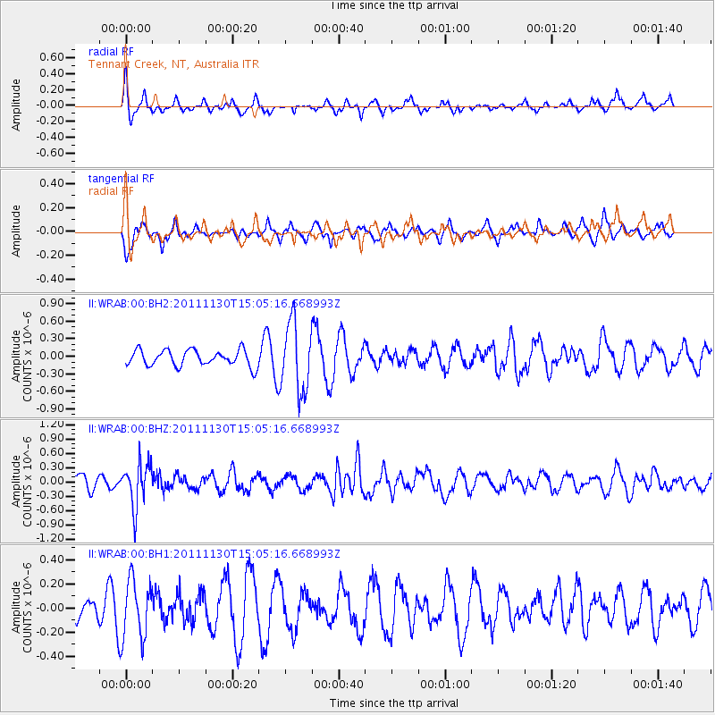
WRAB Tennant Creek, NT, Australia - Earthquake Result Viewer
*The percent match for this event was below the threshold and hence no stack was calculated.
| Earthquake location: |
South Of Fiji Islands |
| Earthquake latitude/longitude: |
-22.2/-176.7 |
| Earthquake time(UTC): |
2011/11/30 (334) 14:57:44 GMT |
| Earthquake Depth: |
172 km |
| Earthquake Magnitude: |
5.6 MW |
| Earthquake Catalog/Contributor: |
NEIC PDE/NEIC PDE-M |
|
| Network: |
II Global Seismograph Network (GSN - IRIS/IDA) |
| Station: |
WRAB Tennant Creek, NT, Australia |
| Lat/Lon: |
19.93 S/134.36 E |
| Elevation: |
366 m |
|
| Distance: |
45.5 deg |
| Az: |
263.391 deg |
| Baz: |
101.844 deg |
| Ray Param: |
$rayparam |
*The percent match for this event was below the threshold and hence was not used in the summary stack. |
|
| Radial Match: |
48.182983 % |
| Radial Bump: |
309 |
| Transverse Match: |
51.105854 % |
| Transverse Bump: |
395 |
| SOD ConfigId: |
558545 |
| Insert Time: |
2013-09-19 07:34:25.785 +0000 |
| GWidth: |
2.5 |
| Max Bumps: |
400 |
| Tol: |
0.001 |
|
Signal To Noise
| Channel | StoN | STA | LTA |
| II:WRAB:00:BHZ:20111130T15:05:16.668993Z | 3.0206616 | 4.571382E-7 | 1.5133712E-7 |
| II:WRAB:00:BH1:20111130T15:05:16.668993Z | 1.7618283 | 2.4210743E-7 | 1.3741828E-7 |
| II:WRAB:00:BH2:20111130T15:05:16.668993Z | 4.356361 | 5.923566E-7 | 1.359751E-7 |
| Arrivals |
| Ps | |
| PpPs | |
| PsPs/PpSs | |


