You are here: Home > Network List > IU - Global Seismograph Network (GSN - IRIS/USGS) Stations List
> Station HNR Honiara, Solomon Islands > Earthquake Result Viewer
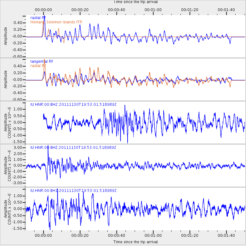
HNR Honiara, Solomon Islands - Earthquake Result Viewer
*The percent match for this event was below the threshold and hence no stack was calculated.
| Earthquake location: |
Nicobar Islands, India Region |
| Earthquake latitude/longitude: |
7.8/93.9 |
| Earthquake time(UTC): |
2011/11/30 (334) 19:42:34 GMT |
| Earthquake Depth: |
17 km |
| Earthquake Magnitude: |
5.5 MB, 5.2 MS, 5.6 MW, 5.5 MW |
| Earthquake Catalog/Contributor: |
WHDF/NEIC |
|
| Network: |
IU Global Seismograph Network (GSN - IRIS/USGS) |
| Station: |
HNR Honiara, Solomon Islands |
| Lat/Lon: |
9.44 S/159.95 E |
| Elevation: |
100 m |
|
| Distance: |
68.0 deg |
| Az: |
103.429 deg |
| Baz: |
282.359 deg |
| Ray Param: |
$rayparam |
*The percent match for this event was below the threshold and hence was not used in the summary stack. |
|
| Radial Match: |
69.536835 % |
| Radial Bump: |
400 |
| Transverse Match: |
65.22483 % |
| Transverse Bump: |
400 |
| SOD ConfigId: |
558545 |
| Insert Time: |
2013-09-19 07:36:36.066 +0000 |
| GWidth: |
2.5 |
| Max Bumps: |
400 |
| Tol: |
0.001 |
|
Signal To Noise
| Channel | StoN | STA | LTA |
| IU:HNR:00:BHZ:20111130T19:53:01.518989Z | 5.3536263 | 1.1096168E-6 | 2.0726453E-7 |
| IU:HNR:00:BH1:20111130T19:53:01.518989Z | 2.0389874 | 6.1877904E-7 | 3.0347368E-7 |
| IU:HNR:00:BH2:20111130T19:53:01.518989Z | 1.5995919 | 4.373817E-7 | 2.734333E-7 |
| Arrivals |
| Ps | |
| PpPs | |
| PsPs/PpSs | |


