You are here: Home > Network List > IU - Global Seismograph Network (GSN - IRIS/USGS) Stations List
> Station MAKZ Makanchi, Kazakhstan > Earthquake Result Viewer
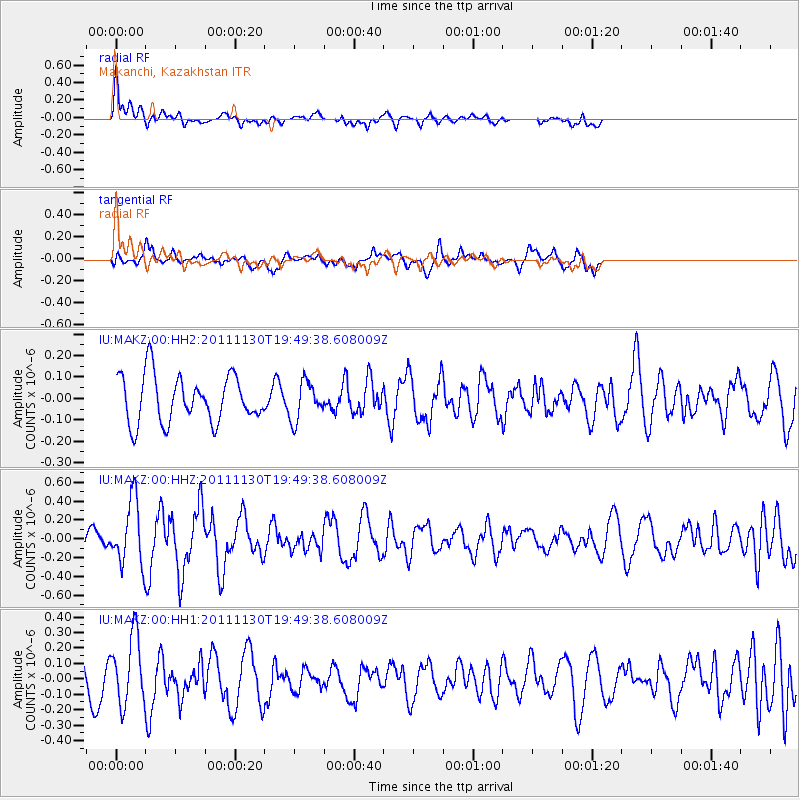
MAKZ Makanchi, Kazakhstan - Earthquake Result Viewer
*The percent match for this event was below the threshold and hence no stack was calculated.
| Earthquake location: |
Nicobar Islands, India Region |
| Earthquake latitude/longitude: |
7.8/93.9 |
| Earthquake time(UTC): |
2011/11/30 (334) 19:42:34 GMT |
| Earthquake Depth: |
17 km |
| Earthquake Magnitude: |
5.5 MB, 5.2 MS, 5.6 MW, 5.5 MW |
| Earthquake Catalog/Contributor: |
WHDF/NEIC |
|
| Network: |
IU Global Seismograph Network (GSN - IRIS/USGS) |
| Station: |
MAKZ Makanchi, Kazakhstan |
| Lat/Lon: |
46.81 N/81.98 E |
| Elevation: |
600 m |
|
| Distance: |
40.2 deg |
| Az: |
347.338 deg |
| Baz: |
161.567 deg |
| Ray Param: |
$rayparam |
*The percent match for this event was below the threshold and hence was not used in the summary stack. |
|
| Radial Match: |
54.63305 % |
| Radial Bump: |
400 |
| Transverse Match: |
60.964443 % |
| Transverse Bump: |
400 |
| SOD ConfigId: |
558545 |
| Insert Time: |
2013-09-19 07:36:47.117 +0000 |
| GWidth: |
2.5 |
| Max Bumps: |
400 |
| Tol: |
0.001 |
|
Signal To Noise
| Channel | StoN | STA | LTA |
| IU:MAKZ:00:HHZ:20111130T19:49:38.608009Z | 2.9156842 | 3.4927155E-7 | 1.197906E-7 |
| IU:MAKZ:00:HH1:20111130T19:49:38.608009Z | 2.8721325 | 2.251829E-7 | 7.8402685E-8 |
| IU:MAKZ:00:HH2:20111130T19:49:38.608009Z | 0.7992374 | 8.7208704E-8 | 1.091149E-7 |
| Arrivals |
| Ps | |
| PpPs | |
| PsPs/PpSs | |


