You are here: Home > Network List > IU - Global Seismograph Network (GSN - IRIS/USGS) Stations List
> Station MAJO Matsushiro, Japan > Earthquake Result Viewer
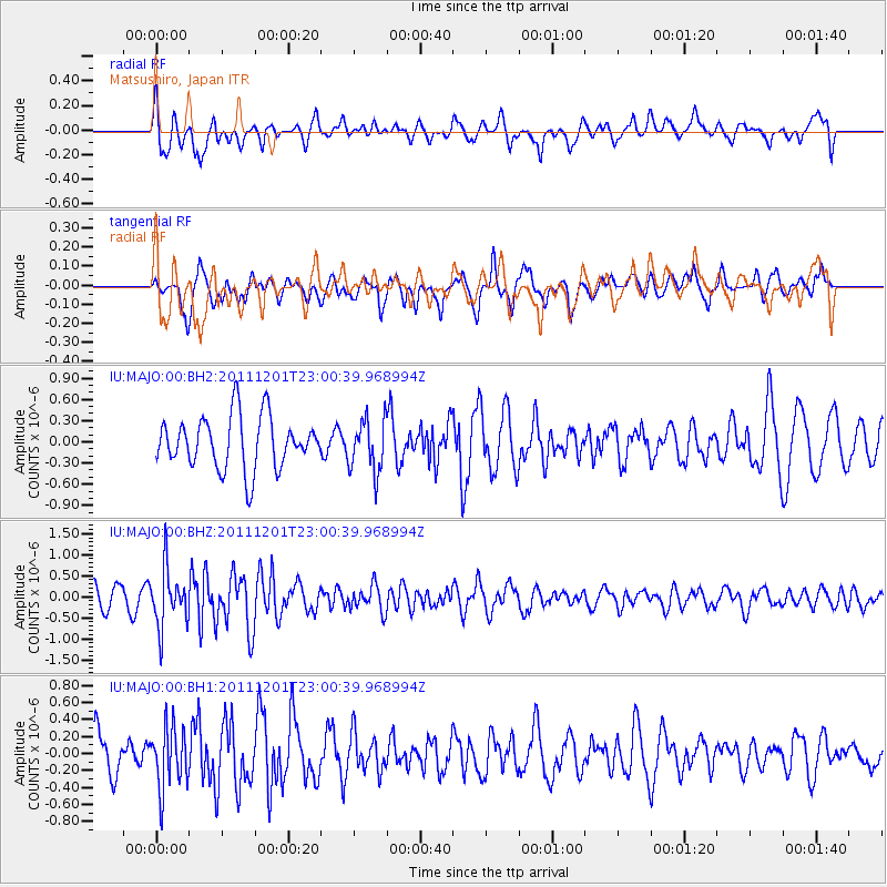
MAJO Matsushiro, Japan - Earthquake Result Viewer
*The percent match for this event was below the threshold and hence no stack was calculated.
| Earthquake location: |
Minahassa Peninsula, Sulawesi |
| Earthquake latitude/longitude: |
-0.6/122.0 |
| Earthquake time(UTC): |
2011/12/01 (335) 22:53:36 GMT |
| Earthquake Depth: |
10 km |
| Earthquake Magnitude: |
5.7 MB |
| Earthquake Catalog/Contributor: |
NEIC PDE/NEIC PDE-W |
|
| Network: |
IU Global Seismograph Network (GSN - IRIS/USGS) |
| Station: |
MAJO Matsushiro, Japan |
| Lat/Lon: |
36.55 N/138.20 E |
| Elevation: |
405 m |
|
| Distance: |
39.9 deg |
| Az: |
20.523 deg |
| Baz: |
205.807 deg |
| Ray Param: |
$rayparam |
*The percent match for this event was below the threshold and hence was not used in the summary stack. |
|
| Radial Match: |
57.936012 % |
| Radial Bump: |
400 |
| Transverse Match: |
54.318962 % |
| Transverse Bump: |
400 |
| SOD ConfigId: |
558545 |
| Insert Time: |
2013-09-19 07:40:20.418 +0000 |
| GWidth: |
2.5 |
| Max Bumps: |
400 |
| Tol: |
0.001 |
|
Signal To Noise
| Channel | StoN | STA | LTA |
| IU:MAJO:00:BHZ:20111201T23:00:39.968994Z | 2.6585329 | 6.7483217E-7 | 2.538363E-7 |
| IU:MAJO:00:BH1:20111201T23:00:39.968994Z | 1.2532705 | 3.618136E-7 | 2.8869553E-7 |
| IU:MAJO:00:BH2:20111201T23:00:39.968994Z | 1.0073656 | 3.7124482E-7 | 3.6853038E-7 |
| Arrivals |
| Ps | |
| PpPs | |
| PsPs/PpSs | |


