You are here: Home > Network List > US - United States National Seismic Network Stations List
> Station EGMT Eagleton, Montana, USA > Earthquake Result Viewer
EGMT Eagleton, Montana, USA - Earthquake Result Viewer
*The percent match for this event was below the threshold and hence no stack was calculated.
| Earthquake location: |
Leeward Islands |
| Earthquake latitude/longitude: |
18.0/-59.8 |
| Earthquake time(UTC): |
2011/12/03 (337) 09:27:11 GMT |
| Earthquake Depth: |
10 km |
| Earthquake Magnitude: |
5.6 MW, 5.2 MS, 5.4 MB, 5.6 MW |
| Earthquake Catalog/Contributor: |
WHDF/NEIC |
|
| Network: |
US United States National Seismic Network |
| Station: |
EGMT Eagleton, Montana, USA |
| Lat/Lon: |
48.02 N/109.75 W |
| Elevation: |
1055 m |
|
| Distance: |
50.3 deg |
| Az: |
318.125 deg |
| Baz: |
108.817 deg |
| Ray Param: |
$rayparam |
*The percent match for this event was below the threshold and hence was not used in the summary stack. |
|
| Radial Match: |
67.54178 % |
| Radial Bump: |
400 |
| Transverse Match: |
47.170147 % |
| Transverse Bump: |
400 |
| SOD ConfigId: |
558545 |
| Insert Time: |
2013-09-19 07:46:22.047 +0000 |
| GWidth: |
2.5 |
| Max Bumps: |
400 |
| Tol: |
0.001 |
|
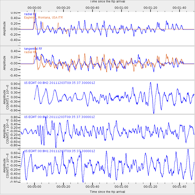
Signal To Noise
| Channel | StoN | STA | LTA |
| US:EGMT:00:BHZ:20111203T09:35:37.300001Z | 1.2062927 | 2.2462454E-7 | 1.8621064E-7 |
| US:EGMT:00:BH1:20111203T09:35:37.300001Z | 0.28979465 | 8.168138E-8 | 2.8185949E-7 |
| US:EGMT:00:BH2:20111203T09:35:37.300001Z | 0.598381 | 1.906807E-7 | 3.1866102E-7 |
| Arrivals |
| Ps | |
| PpPs | |
| PsPs/PpSs | |


