You are here: Home > Network List > IU - Global Seismograph Network (GSN - IRIS/USGS) Stations List
> Station MAKZ Makanchi, Kazakhstan > Earthquake Result Viewer
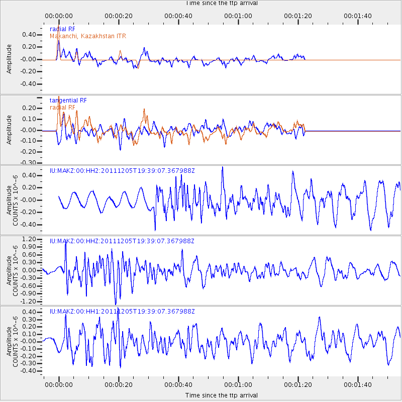
MAKZ Makanchi, Kazakhstan - Earthquake Result Viewer
*The percent match for this event was below the threshold and hence no stack was calculated.
| Earthquake location: |
Irian Jaya Region, Indonesia |
| Earthquake latitude/longitude: |
-4.8/133.6 |
| Earthquake time(UTC): |
2011/12/05 (339) 19:28:36 GMT |
| Earthquake Depth: |
19 km |
| Earthquake Magnitude: |
5.7 MB, 5.6 MS, 5.7 MW |
| Earthquake Catalog/Contributor: |
WHDF/NEIC |
|
| Network: |
IU Global Seismograph Network (GSN - IRIS/USGS) |
| Station: |
MAKZ Makanchi, Kazakhstan |
| Lat/Lon: |
46.81 N/81.98 E |
| Elevation: |
600 m |
|
| Distance: |
68.6 deg |
| Az: |
324.647 deg |
| Baz: |
122.911 deg |
| Ray Param: |
$rayparam |
*The percent match for this event was below the threshold and hence was not used in the summary stack. |
|
| Radial Match: |
63.050552 % |
| Radial Bump: |
400 |
| Transverse Match: |
66.89353 % |
| Transverse Bump: |
400 |
| SOD ConfigId: |
558545 |
| Insert Time: |
2013-09-19 07:48:25.913 +0000 |
| GWidth: |
2.5 |
| Max Bumps: |
400 |
| Tol: |
0.001 |
|
Signal To Noise
| Channel | StoN | STA | LTA |
| IU:MAKZ:00:HHZ:20111205T19:39:07.367988Z | 3.3507876 | 3.8518778E-7 | 1.149544E-7 |
| IU:MAKZ:00:HH1:20111205T19:39:07.367988Z | 2.0698814 | 1.4463907E-7 | 6.987794E-8 |
| IU:MAKZ:00:HH2:20111205T19:39:07.367988Z | 1.8054217 | 1.7166394E-7 | 9.508246E-8 |
| Arrivals |
| Ps | |
| PpPs | |
| PsPs/PpSs | |


