You are here: Home > Network List > IU - Global Seismograph Network (GSN - IRIS/USGS) Stations List
> Station MAJO Matsushiro, Japan > Earthquake Result Viewer
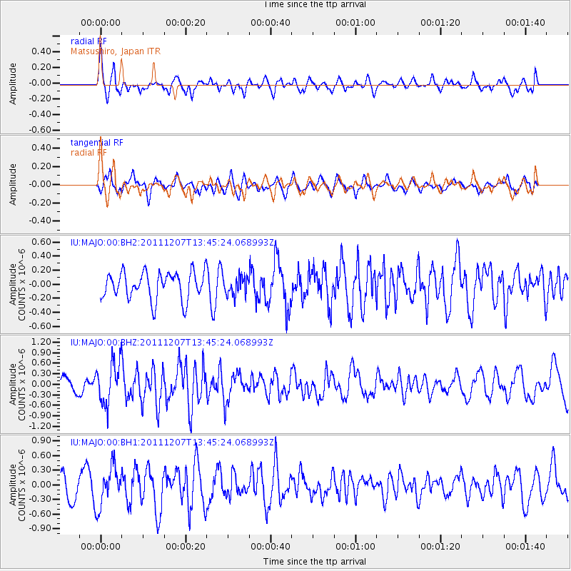
MAJO Matsushiro, Japan - Earthquake Result Viewer
*The percent match for this event was below the threshold and hence no stack was calculated.
| Earthquake location: |
Southern Molucca Sea |
| Earthquake latitude/longitude: |
-1.4/126.5 |
| Earthquake time(UTC): |
2011/12/07 (341) 13:38:28 GMT |
| Earthquake Depth: |
28 km |
| Earthquake Magnitude: |
5.8 MB, 5.7 MS, 5.8 MW, 5.9 MW |
| Earthquake Catalog/Contributor: |
WHDF/NEIC |
|
| Network: |
IU Global Seismograph Network (GSN - IRIS/USGS) |
| Station: |
MAJO Matsushiro, Japan |
| Lat/Lon: |
36.55 N/138.20 E |
| Elevation: |
405 m |
|
| Distance: |
39.3 deg |
| Az: |
14.92 deg |
| Baz: |
198.64 deg |
| Ray Param: |
$rayparam |
*The percent match for this event was below the threshold and hence was not used in the summary stack. |
|
| Radial Match: |
66.77537 % |
| Radial Bump: |
400 |
| Transverse Match: |
66.77381 % |
| Transverse Bump: |
400 |
| SOD ConfigId: |
558545 |
| Insert Time: |
2013-09-19 07:50:17.285 +0000 |
| GWidth: |
2.5 |
| Max Bumps: |
400 |
| Tol: |
0.001 |
|
Signal To Noise
| Channel | StoN | STA | LTA |
| IU:MAJO:00:BHZ:20111207T13:45:24.068993Z | 3.2026582 | 6.030676E-7 | 1.883022E-7 |
| IU:MAJO:00:BH1:20111207T13:45:24.068993Z | 2.3577335 | 3.925784E-7 | 1.6650668E-7 |
| IU:MAJO:00:BH2:20111207T13:45:24.068993Z | 0.65479404 | 1.2680547E-7 | 1.9365704E-7 |
| Arrivals |
| Ps | |
| PpPs | |
| PsPs/PpSs | |


