You are here: Home > Network List > US - United States National Seismic Network Stations List
> Station ACSO Alum Creek State Park, Ohio, USA > Earthquake Result Viewer
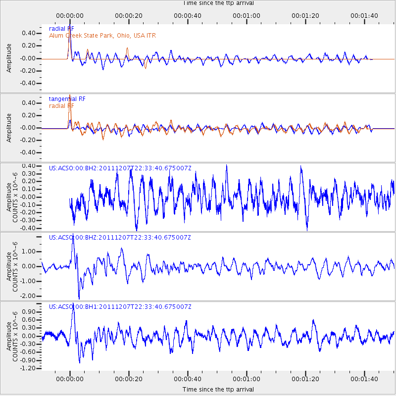
ACSO Alum Creek State Park, Ohio, USA - Earthquake Result Viewer
*The percent match for this event was below the threshold and hence no stack was calculated.
| Earthquake location: |
Near Coast Of Northern Chile |
| Earthquake latitude/longitude: |
-27.9/-70.9 |
| Earthquake time(UTC): |
2011/12/07 (341) 22:23:09 GMT |
| Earthquake Depth: |
20 km |
| Earthquake Magnitude: |
5.8 MB, 5.8 MS, 6.1 MW, 6.0 MW |
| Earthquake Catalog/Contributor: |
WHDF/NEIC |
|
| Network: |
US United States National Seismic Network |
| Station: |
ACSO Alum Creek State Park, Ohio, USA |
| Lat/Lon: |
40.23 N/82.98 W |
| Elevation: |
288 m |
|
| Distance: |
68.7 deg |
| Az: |
350.111 deg |
| Baz: |
168.549 deg |
| Ray Param: |
$rayparam |
*The percent match for this event was below the threshold and hence was not used in the summary stack. |
|
| Radial Match: |
68.87091 % |
| Radial Bump: |
400 |
| Transverse Match: |
56.76057 % |
| Transverse Bump: |
400 |
| SOD ConfigId: |
558545 |
| Insert Time: |
2013-09-19 07:54:19.594 +0000 |
| GWidth: |
2.5 |
| Max Bumps: |
400 |
| Tol: |
0.001 |
|
Signal To Noise
| Channel | StoN | STA | LTA |
| US:ACSO:00:BHZ:20111207T22:33:40.675007Z | 4.9200563 | 1.0681289E-6 | 2.170969E-7 |
| US:ACSO:00:BH1:20111207T22:33:40.675007Z | 4.0488863 | 5.636832E-7 | 1.3921932E-7 |
| US:ACSO:00:BH2:20111207T22:33:40.675007Z | 0.9567142 | 1.5164561E-7 | 1.585067E-7 |
| Arrivals |
| Ps | |
| PpPs | |
| PsPs/PpSs | |


