You are here: Home > Network List > US - United States National Seismic Network Stations List
> Station NATX Nacogdoches, Texas, USA > Earthquake Result Viewer
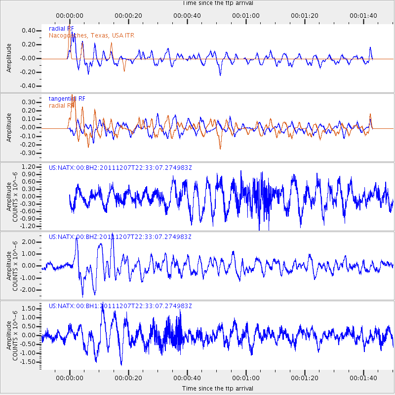
NATX Nacogdoches, Texas, USA - Earthquake Result Viewer

| Earthquake location: |
Near Coast Of Northern Chile |
| Earthquake latitude/longitude: |
-27.9/-70.9 |
| Earthquake time(UTC): |
2011/12/07 (341) 22:23:09 GMT |
| Earthquake Depth: |
20 km |
| Earthquake Magnitude: |
5.8 MB, 5.8 MS, 6.1 MW, 6.0 MW |
| Earthquake Catalog/Contributor: |
WHDF/NEIC |
|
| Network: |
US United States National Seismic Network |
| Station: |
NATX Nacogdoches, Texas, USA |
| Lat/Lon: |
31.76 N/94.66 W |
| Elevation: |
156 m |
|
| Distance: |
63.5 deg |
| Az: |
337.464 deg |
| Baz: |
156.533 deg |
| Ray Param: |
0.05952002 |
| Estimated Moho Depth: |
10.0 km |
| Estimated Crust Vp/Vs: |
1.60 |
| Assumed Crust Vp: |
5.738 km/s |
| Estimated Crust Vs: |
3.587 km/s |
| Estimated Crust Poisson's Ratio: |
0.18 |
|
| Radial Match: |
86.46233 % |
| Radial Bump: |
400 |
| Transverse Match: |
68.6079 % |
| Transverse Bump: |
400 |
| SOD ConfigId: |
558545 |
| Insert Time: |
2013-09-19 07:56:12.184 +0000 |
| GWidth: |
2.5 |
| Max Bumps: |
400 |
| Tol: |
0.001 |
|
Signal To Noise
| Channel | StoN | STA | LTA |
| US:NATX:00:BHZ:20111207T22:33:07.274983Z | 7.58715 | 1.170762E-6 | 1.5430852E-7 |
| US:NATX:00:BH1:20111207T22:33:07.274983Z | 1.9673486 | 3.6268028E-7 | 1.8434977E-7 |
| US:NATX:00:BH2:20111207T22:33:07.274983Z | 1.1511128 | 2.9324295E-7 | 2.5474736E-7 |
| Arrivals |
| Ps | 1.1 SECOND |
| PpPs | 4.4 SECOND |
| PsPs/PpSs | 5.4 SECOND |


