LLLB LILLOOET, BC, CANADA ADA - Earthquake Result Viewer
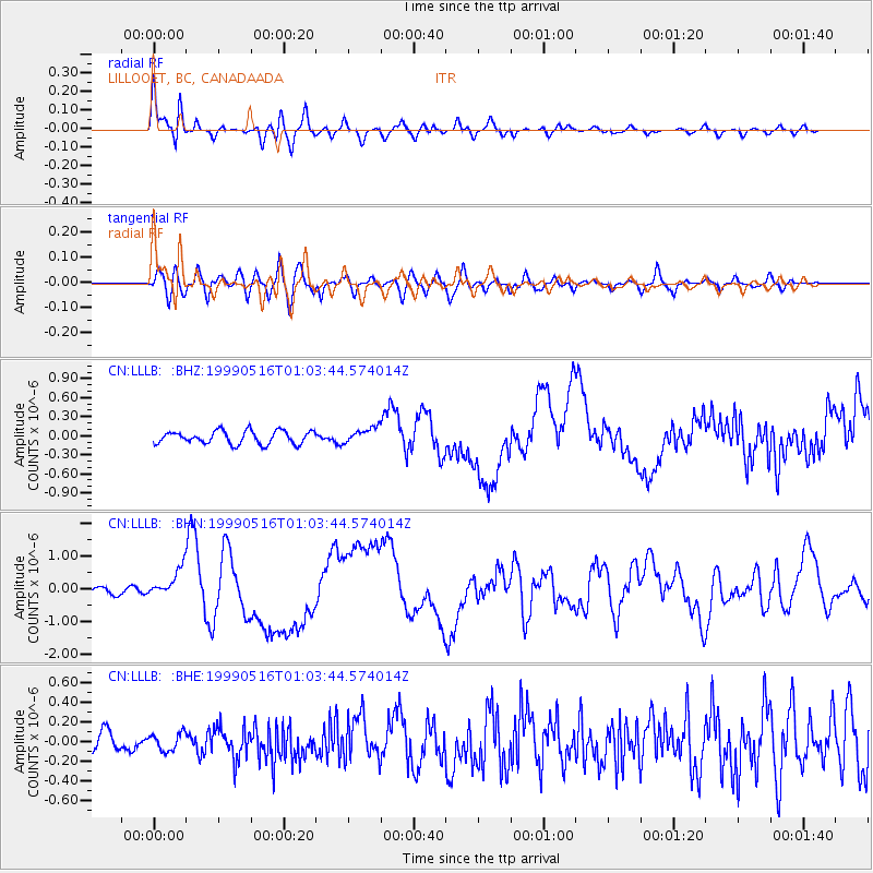
Earthquake location: New Britain Region, P.N.G.
Earthquake latitude/longitude: -4.8/152.5
Earthquake time(UTC): 1999/05/16 (136) 00:51:20 GMT
Earthquake Depth: 74 km
Earthquake Magnitude: 6.0 MB, 7.0 MS, 7.1 MW, 6.3 ME
Earthquake Catalog/Contributor: WHDF/NEIC
Network: CN Canadian National Seismograph Network
Station: LLLB LILLOOET, BC, CANADA ADA
Lat/Lon: 50.61 N/121.88 W
Elevation: 700 m
Distance: 90.9 deg
Az: 39.448 deg
Baz: 263.631 deg
Ray Param: 0.041629773
Estimated Moho Depth: 29.0 km
Estimated Crust Vp/Vs: 1.94
Assumed Crust Vp: 6.597 km/s
Estimated Crust Vs: 3.405 km/s
Estimated Crust Poisson's Ratio: 0.32
Radial Match: 87.27543 %
Radial Bump: 400
Transverse Match: 67.01911 %
Transverse Bump: 400
SOD ConfigId: 4480
Insert Time: 2010-02-27 06:36:23.491 +0000
GWidth: 2.5
Max Bumps: 400
Tol: 0.001

Signal To Noise

ChannelStoNSTALTA
CN:LLLB: :BHN:19990516T01:03:44.574014Z3.83209664.331095E-71.1302155E-7
CN:LLLB: :BHE:19990516T01:03:44.574014Z0.70459588.78944E-81.2474443E-7
CN:LLLB: :BHZ:19990516T01:03:44.574014Z1.20317521.2203915E-71.0143091E-7
Arrivals
Ps4.2 SECOND
PpPs13 SECOND
PsPs/PpSs17 SECOND