You are here: Home > Network List > US - United States National Seismic Network Stations List
> Station AMTX Amarillo, Texas, USA > Earthquake Result Viewer
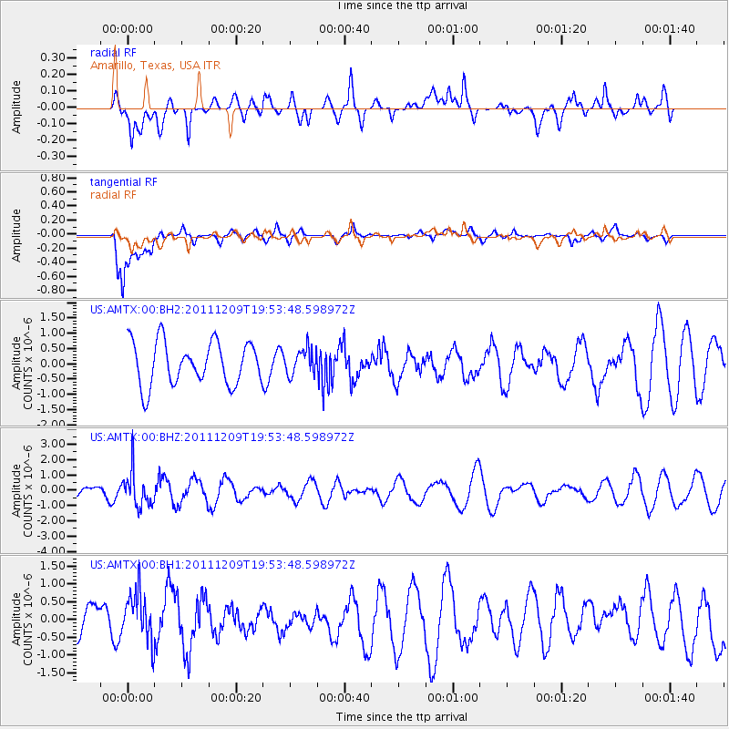
AMTX Amarillo, Texas, USA - Earthquake Result Viewer
*The percent match for this event was below the threshold and hence no stack was calculated.
| Earthquake location: |
Sea Of Okhotsk |
| Earthquake latitude/longitude: |
47.0/144.6 |
| Earthquake time(UTC): |
2011/12/09 (343) 19:42:57 GMT |
| Earthquake Depth: |
392 km |
| Earthquake Magnitude: |
5.7 MB, 5.7 MW, 5.8 MW |
| Earthquake Catalog/Contributor: |
WHDF/NEIC |
|
| Network: |
US United States National Seismic Network |
| Station: |
AMTX Amarillo, Texas, USA |
| Lat/Lon: |
34.53 N/101.41 W |
| Elevation: |
1010 m |
|
| Distance: |
79.6 deg |
| Az: |
50.057 deg |
| Baz: |
320.543 deg |
| Ray Param: |
$rayparam |
*The percent match for this event was below the threshold and hence was not used in the summary stack. |
|
| Radial Match: |
41.66415 % |
| Radial Bump: |
400 |
| Transverse Match: |
80.95163 % |
| Transverse Bump: |
400 |
| SOD ConfigId: |
558545 |
| Insert Time: |
2013-09-19 08:00:16.291 +0000 |
| GWidth: |
2.5 |
| Max Bumps: |
400 |
| Tol: |
0.001 |
|
Signal To Noise
| Channel | StoN | STA | LTA |
| US:AMTX:00:BHZ:20111209T19:53:48.598972Z | 3.5207622 | 1.1364383E-6 | 3.227819E-7 |
| US:AMTX:00:BH1:20111209T19:53:48.598972Z | 1.3982856 | 7.5723506E-7 | 5.415453E-7 |
| US:AMTX:00:BH2:20111209T19:53:48.598972Z | 0.82382154 | 5.609283E-7 | 6.8088565E-7 |
| Arrivals |
| Ps | |
| PpPs | |
| PsPs/PpSs | |


