You are here: Home > Network List > US - United States National Seismic Network Stations List
> Station OGNE Ogallala, Nebraska, USA > Earthquake Result Viewer
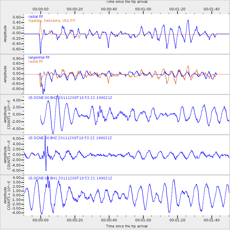
OGNE Ogallala, Nebraska, USA - Earthquake Result Viewer
*The percent match for this event was below the threshold and hence no stack was calculated.
| Earthquake location: |
Sea Of Okhotsk |
| Earthquake latitude/longitude: |
47.0/144.6 |
| Earthquake time(UTC): |
2011/12/09 (343) 19:42:57 GMT |
| Earthquake Depth: |
392 km |
| Earthquake Magnitude: |
5.7 MB, 5.7 MW, 5.8 MW |
| Earthquake Catalog/Contributor: |
WHDF/NEIC |
|
| Network: |
US United States National Seismic Network |
| Station: |
OGNE Ogallala, Nebraska, USA |
| Lat/Lon: |
40.95 N/102.03 W |
| Elevation: |
0.0 m |
|
| Distance: |
74.3 deg |
| Az: |
46.215 deg |
| Baz: |
319.293 deg |
| Ray Param: |
$rayparam |
*The percent match for this event was below the threshold and hence was not used in the summary stack. |
|
| Radial Match: |
50.299854 % |
| Radial Bump: |
400 |
| Transverse Match: |
84.23801 % |
| Transverse Bump: |
400 |
| SOD ConfigId: |
558545 |
| Insert Time: |
2013-09-19 08:01:38.607 +0000 |
| GWidth: |
2.5 |
| Max Bumps: |
400 |
| Tol: |
0.001 |
|
Signal To Noise
| Channel | StoN | STA | LTA |
| US:OGNE:00:BHZ:20111209T19:53:22.149021Z | 2.5800915 | 2.2568022E-6 | 8.746985E-7 |
| US:OGNE:00:BH1:20111209T19:53:22.149021Z | 2.100447 | 2.7663925E-6 | 1.3170494E-6 |
| US:OGNE:00:BH2:20111209T19:53:22.149021Z | 0.6574443 | 1.7009445E-6 | 2.5872068E-6 |
| Arrivals |
| Ps | |
| PpPs | |
| PsPs/PpSs | |


