You are here: Home > Network List > II - Global Seismograph Network (GSN - IRIS/IDA) Stations List
> Station WRAB Tennant Creek, NT, Australia > Earthquake Result Viewer
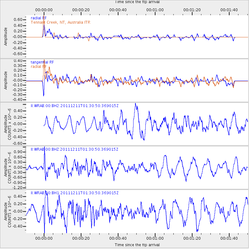
WRAB Tennant Creek, NT, Australia - Earthquake Result Viewer
*The percent match for this event was below the threshold and hence no stack was calculated.
| Earthquake location: |
Ryukyu Islands, Japan |
| Earthquake latitude/longitude: |
28.1/129.4 |
| Earthquake time(UTC): |
2011/12/11 (345) 01:22:45 GMT |
| Earthquake Depth: |
38 km |
| Earthquake Magnitude: |
5.7 MB, 5.3 MW, 5.4 MW |
| Earthquake Catalog/Contributor: |
WHDF/NEIC |
|
| Network: |
II Global Seismograph Network (GSN - IRIS/IDA) |
| Station: |
WRAB Tennant Creek, NT, Australia |
| Lat/Lon: |
19.93 S/134.36 E |
| Elevation: |
366 m |
|
| Distance: |
48.0 deg |
| Az: |
173.671 deg |
| Baz: |
354.059 deg |
| Ray Param: |
$rayparam |
*The percent match for this event was below the threshold and hence was not used in the summary stack. |
|
| Radial Match: |
59.83952 % |
| Radial Bump: |
400 |
| Transverse Match: |
52.58797 % |
| Transverse Bump: |
400 |
| SOD ConfigId: |
558545 |
| Insert Time: |
2013-09-19 08:04:06.794 +0000 |
| GWidth: |
2.5 |
| Max Bumps: |
400 |
| Tol: |
0.001 |
|
Signal To Noise
| Channel | StoN | STA | LTA |
| II:WRAB:00:BHZ:20111211T01:30:50.369015Z | 1.5545254 | 3.9279274E-7 | 2.5267695E-7 |
| II:WRAB:00:BH1:20111211T01:30:50.369015Z | 2.6874294 | 3.0170025E-7 | 1.122635E-7 |
| II:WRAB:00:BH2:20111211T01:30:50.369015Z | 1.0805374 | 1.7053546E-7 | 1.5782467E-7 |
| Arrivals |
| Ps | |
| PpPs | |
| PsPs/PpSs | |


