LLLB LILLOOET, BC, CANADA ADA - Earthquake Result Viewer
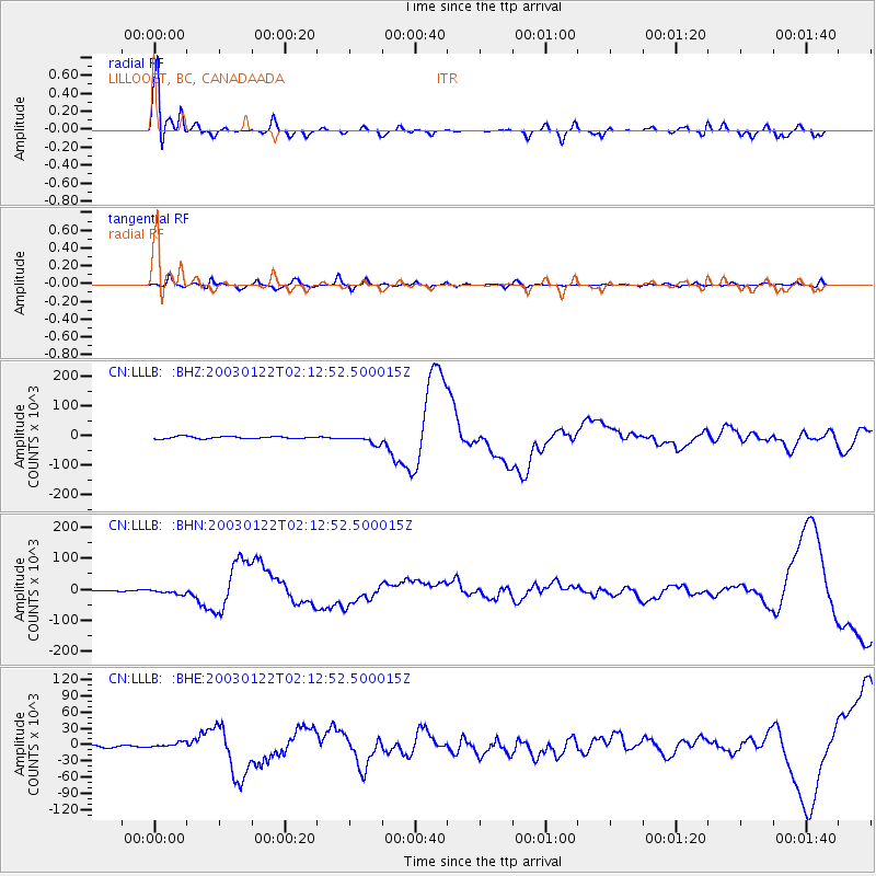
Earthquake location: Near Coast Of Jalisco, Mexico
Earthquake latitude/longitude: 18.8/-104.1
Earthquake time(UTC): 2003/01/22 (022) 02:06:34 GMT
Earthquake Depth: 24 km
Earthquake Magnitude: 6.5 MB, 7.6 MS, 7.6 MW, 7.4 MW
Earthquake Catalog/Contributor: WHDF/NEIC
Network: CN Canadian National Seismograph Network
Station: LLLB LILLOOET, BC, CANADA ADA
Lat/Lon: 50.61 N/121.88 W
Elevation: 700 m
Distance: 34.8 deg
Az: 340.059 deg
Baz: 149.525 deg
Ray Param: 0.07753146
Estimated Moho Depth: 15.25 km
Estimated Crust Vp/Vs: 2.08
Assumed Crust Vp: 6.597 km/s
Estimated Crust Vs: 3.172 km/s
Estimated Crust Poisson's Ratio: 0.35
Radial Match: 91.561485 %
Radial Bump: 316
Transverse Match: 66.398476 %
Transverse Bump: 400
SOD ConfigId: 4714
Insert Time: 2010-02-27 06:36:51.806 +0000
GWidth: 2.5
Max Bumps: 400
Tol: 0.001

Signal To Noise

ChannelStoNSTALTA
CN:LLLB: :BHN:20030122T02:12:52.500015Z3.08474838745.52052835.084
CN:LLLB: :BHE:20030122T02:12:52.500015Z2.6224115503.4482098.6216
CN:LLLB: :BHZ:20030122T02:12:52.500015Z4.285193415354.1473583.07
Arrivals
Ps2.7 SECOND
PpPs6.6 SECOND
PsPs/PpSs9.3 SECOND