You are here: Home > Network List > II - Global Seismograph Network (GSN - IRIS/IDA) Stations List
> Station CMLA Cha de Macela, Sao Miguel Island, Azores > Earthquake Result Viewer
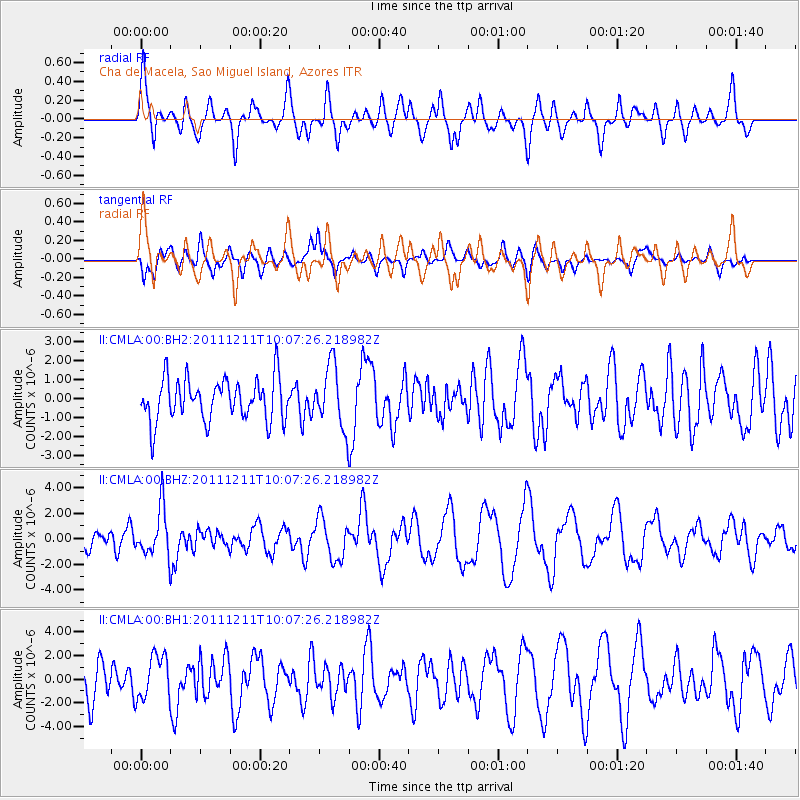
CMLA Cha de Macela, Sao Miguel Island, Azores - Earthquake Result Viewer
*The percent match for this event was below the threshold and hence no stack was calculated.
| Earthquake location: |
South Sandwich Islands Region |
| Earthquake latitude/longitude: |
-56.0/-28.2 |
| Earthquake time(UTC): |
2011/12/11 (345) 09:54:55 GMT |
| Earthquake Depth: |
116 km |
| Earthquake Magnitude: |
6.1 MB, 6.2 MW, 6.2 MW |
| Earthquake Catalog/Contributor: |
WHDF/NEIC |
|
| Network: |
II Global Seismograph Network (GSN - IRIS/IDA) |
| Station: |
CMLA Cha de Macela, Sao Miguel Island, Azores |
| Lat/Lon: |
37.76 N/25.52 W |
| Elevation: |
429 m |
|
| Distance: |
93.4 deg |
| Az: |
2.111 deg |
| Baz: |
181.496 deg |
| Ray Param: |
$rayparam |
*The percent match for this event was below the threshold and hence was not used in the summary stack. |
|
| Radial Match: |
59.970398 % |
| Radial Bump: |
400 |
| Transverse Match: |
62.26829 % |
| Transverse Bump: |
400 |
| SOD ConfigId: |
558545 |
| Insert Time: |
2013-09-19 08:13:53.384 +0000 |
| GWidth: |
2.5 |
| Max Bumps: |
400 |
| Tol: |
0.001 |
|
Signal To Noise
| Channel | StoN | STA | LTA |
| II:CMLA:00:BHZ:20111211T10:07:26.218982Z | 2.2128432 | 1.8647652E-6 | 8.42701E-7 |
| II:CMLA:00:BH1:20111211T10:07:26.218982Z | 1.078746 | 1.8763221E-6 | 1.739355E-6 |
| II:CMLA:00:BH2:20111211T10:07:26.218982Z | 1.4795271 | 1.6362426E-6 | 1.1059227E-6 |
| Arrivals |
| Ps | |
| PpPs | |
| PsPs/PpSs | |


