You are here: Home > Network List > US - United States National Seismic Network Stations List
> Station MIAR Mount Ida, Arkansas, USA > Earthquake Result Viewer
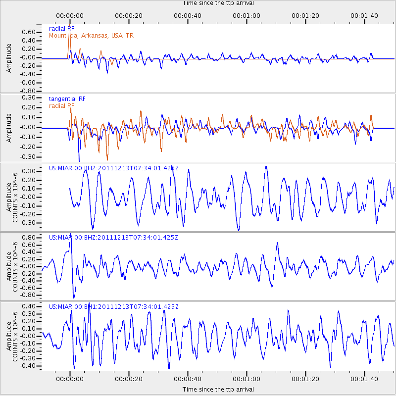
MIAR Mount Ida, Arkansas, USA - Earthquake Result Viewer
*The percent match for this event was below the threshold and hence no stack was calculated.
| Earthquake location: |
South Of Panama |
| Earthquake latitude/longitude: |
4.8/-82.6 |
| Earthquake time(UTC): |
2011/12/13 (347) 07:28:11 GMT |
| Earthquake Depth: |
7.0 km |
| Earthquake Magnitude: |
5.5 MW, 5.5 MB |
| Earthquake Catalog/Contributor: |
NEIC PDE/NEIC PDE-M |
|
| Network: |
US United States National Seismic Network |
| Station: |
MIAR Mount Ida, Arkansas, USA |
| Lat/Lon: |
34.55 N/93.58 W |
| Elevation: |
207 m |
|
| Distance: |
31.3 deg |
| Az: |
342.381 deg |
| Baz: |
158.565 deg |
| Ray Param: |
$rayparam |
*The percent match for this event was below the threshold and hence was not used in the summary stack. |
|
| Radial Match: |
46.49064 % |
| Radial Bump: |
400 |
| Transverse Match: |
57.83298 % |
| Transverse Bump: |
302 |
| SOD ConfigId: |
558545 |
| Insert Time: |
2013-09-19 08:18:21.570 +0000 |
| GWidth: |
2.5 |
| Max Bumps: |
400 |
| Tol: |
0.001 |
|
Signal To Noise
| Channel | StoN | STA | LTA |
| US:MIAR:00:BHZ:20111213T07:34:01.425Z | 2.5226676 | 5.069587E-7 | 2.0096137E-7 |
| US:MIAR:00:BH1:20111213T07:34:01.425Z | 1.4362313 | 2.0774256E-7 | 1.4464423E-7 |
| US:MIAR:00:BH2:20111213T07:34:01.425Z | 0.983705 | 1.6231472E-7 | 1.6500346E-7 |
| Arrivals |
| Ps | |
| PpPs | |
| PsPs/PpSs | |


