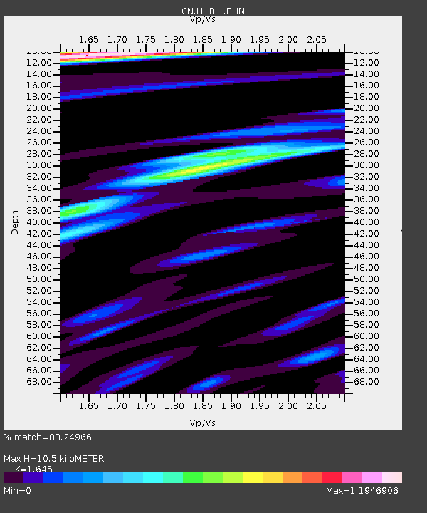
LLLB LILLOOET, BC, CANADA ADA - Earthquake Result Viewer
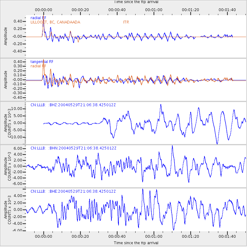
Earthquake location: Off East Coast Of Honshu, Japan
Earthquake latitude/longitude: 34.3/141.4
Earthquake time(UTC): 2004/05/29 (150) 20:56:09 GMT
Earthquake Depth: 16 km
Earthquake Magnitude: 5.6 MB, 6.6 MS, 6.5 MW, 6.3 MW
Earthquake Catalog/Contributor: WHDF/NEIC
Network: CN Canadian National Seismograph Network
Station: LLLB LILLOOET, BC, CANADA ADA
Lat/Lon: 50.61 N/121.88 W
Elevation: 700 m
Distance: 68.3 deg
Az: 42.934 deg
Baz: 297.682 deg
Ray Param: 0.05639631
Estimated Moho Depth: 10.5 km
Estimated Crust Vp/Vs: 1.64
Assumed Crust Vp: 6.597 km/s
Estimated Crust Vs: 4.011 km/s
Estimated Crust Poisson's Ratio: 0.21
Radial Match: 88.24966 %
Radial Bump: 400
Transverse Match: 81.07054 %
Transverse Bump: 400
SOD ConfigId: 2459
Insert Time: 2010-02-27 06:37:08.171 +0000
GWidth: 2.5
Max Bumps: 400
Tol: 0.001

Signal To Noise

ChannelStoNSTALTA
CN:LLLB: :BHN:20040529T21:06:38.425012Z1.2642367733.94525580.5442
CN:LLLB: :BHE:20040529T21:06:38.425012Z1.9637926900.49316458.548
CN:LLLB: :BHZ:20040529T21:06:38.425012Z4.1740441885.2755451.66638
Arrivals
Ps1.1 SECOND
PpPs4.0 SECOND
PsPs/PpSs5.1 SECOND