You are here: Home > Network List > US - United States National Seismic Network Stations List
> Station WUAZ Wupatki, Arizona, USA > Earthquake Result Viewer
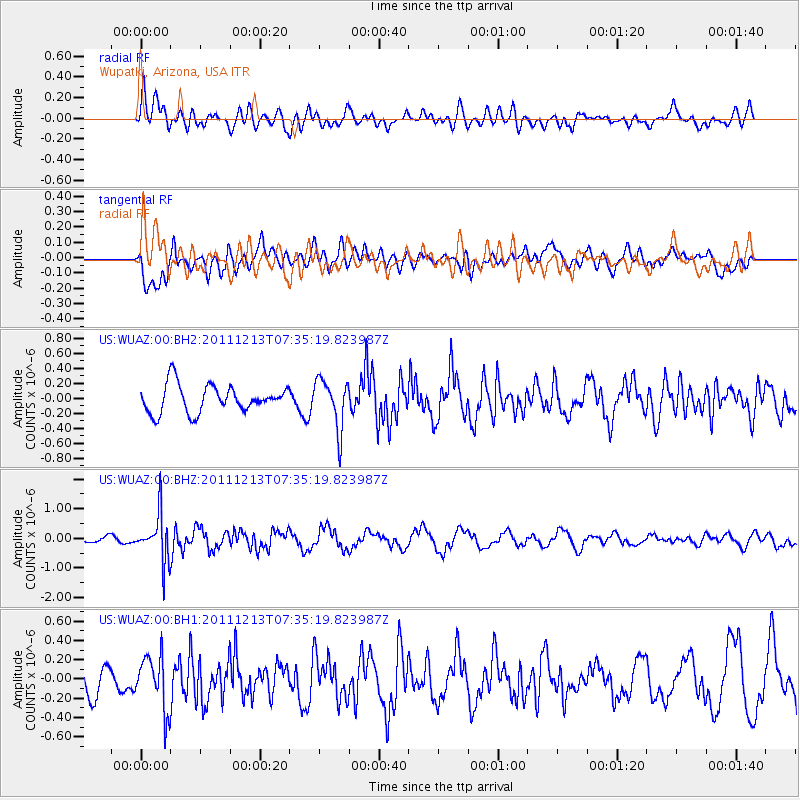
WUAZ Wupatki, Arizona, USA - Earthquake Result Viewer
*The percent match for this event was below the threshold and hence no stack was calculated.
| Earthquake location: |
South Of Panama |
| Earthquake latitude/longitude: |
4.8/-82.6 |
| Earthquake time(UTC): |
2011/12/13 (347) 07:28:11 GMT |
| Earthquake Depth: |
7.0 km |
| Earthquake Magnitude: |
5.5 MW, 5.5 MB |
| Earthquake Catalog/Contributor: |
NEIC PDE/NEIC PDE-M |
|
| Network: |
US United States National Seismic Network |
| Station: |
WUAZ Wupatki, Arizona, USA |
| Lat/Lon: |
35.52 N/111.37 W |
| Elevation: |
1592 m |
|
| Distance: |
40.5 deg |
| Az: |
322.792 deg |
| Baz: |
132.375 deg |
| Ray Param: |
$rayparam |
*The percent match for this event was below the threshold and hence was not used in the summary stack. |
|
| Radial Match: |
66.19423 % |
| Radial Bump: |
400 |
| Transverse Match: |
66.44162 % |
| Transverse Bump: |
400 |
| SOD ConfigId: |
558545 |
| Insert Time: |
2013-09-19 08:18:57.995 +0000 |
| GWidth: |
2.5 |
| Max Bumps: |
400 |
| Tol: |
0.001 |
|
Signal To Noise
| Channel | StoN | STA | LTA |
| US:WUAZ:00:BHZ:20111213T07:35:19.823987Z | 6.4913273 | 7.831244E-7 | 1.2064164E-7 |
| US:WUAZ:00:BH1:20111213T07:35:19.823987Z | 1.602913 | 2.836323E-7 | 1.7694802E-7 |
| US:WUAZ:00:BH2:20111213T07:35:19.823987Z | 1.8027089 | 3.317502E-7 | 1.840287E-7 |
| Arrivals |
| Ps | |
| PpPs | |
| PsPs/PpSs | |


