LLLB LILLOOET, BC, CANADA ADA - Earthquake Result Viewer
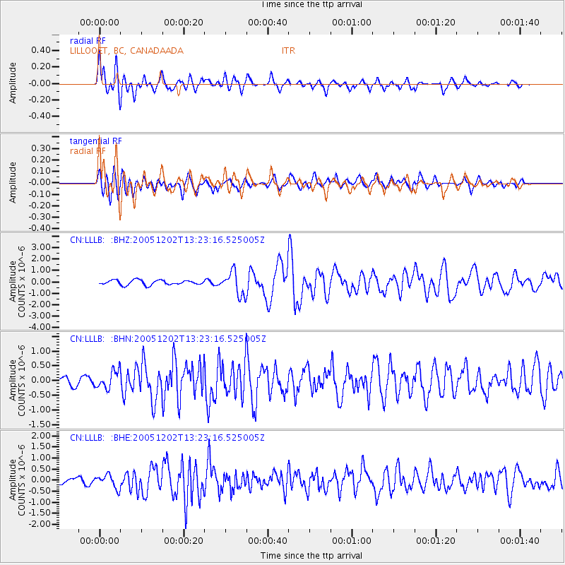
Earthquake location: Near East Coast Of Honshu, Japan
Earthquake latitude/longitude: 38.1/142.1
Earthquake time(UTC): 2005/12/02 (336) 13:13:09 GMT
Earthquake Depth: 29 km
Earthquake Magnitude: 6.1 MB, 6.3 MS, 6.5 MW, 6.4 MW
Earthquake Catalog/Contributor: WHDF/NEIC
Network: CN Canadian National Seismograph Network
Station: LLLB LILLOOET, BC, CANADA ADA
Lat/Lon: 50.61 N/121.88 W
Elevation: 700 m
Distance: 65.1 deg
Az: 44.313 deg
Baz: 300.103 deg
Ray Param: 0.058447123
Estimated Moho Depth: 10.75 km
Estimated Crust Vp/Vs: 1.60
Assumed Crust Vp: 6.597 km/s
Estimated Crust Vs: 4.123 km/s
Estimated Crust Poisson's Ratio: 0.18
Radial Match: 87.67865 %
Radial Bump: 400
Transverse Match: 81.449486 %
Transverse Bump: 400
SOD ConfigId: 2564
Insert Time: 2010-02-27 06:37:21.535 +0000
GWidth: 2.5
Max Bumps: 400
Tol: 0.001

Signal To Noise

ChannelStoNSTALTA
CN:LLLB: :BHN:20051202T13:23:16.525005Z2.61300233.11416E-71.19179376E-7
CN:LLLB: :BHE:20051202T13:23:16.525005Z2.59857943.103012E-71.1941185E-7
CN:LLLB: :BHZ:20051202T13:23:16.525005Z5.11658051.057019E-62.06587E-7
Arrivals
Ps1.0 SECOND
PpPs4.0 SECOND
PsPs/PpSs5.1 SECOND