You are here: Home > Network List > IU - Global Seismograph Network (GSN - IRIS/USGS) Stations List
> Station PMG Port Moresby, New Guinea > Earthquake Result Viewer
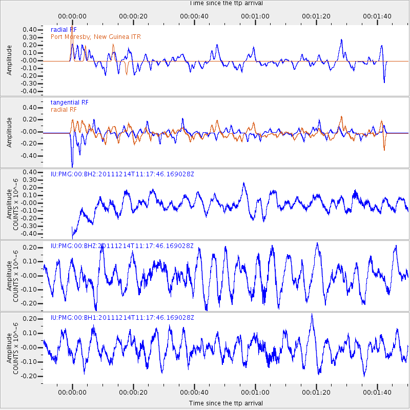
PMG Port Moresby, New Guinea - Earthquake Result Viewer
*The percent match for this event was below the threshold and hence no stack was calculated.
| Earthquake location: |
Pacific-Antarctic Ridge |
| Earthquake latitude/longitude: |
-56.5/-143.7 |
| Earthquake time(UTC): |
2011/12/14 (348) 11:07:01 GMT |
| Earthquake Depth: |
10 km |
| Earthquake Magnitude: |
5.5 MW |
| Earthquake Catalog/Contributor: |
NEIC PDE/NEIC PDE-M |
|
| Network: |
IU Global Seismograph Network (GSN - IRIS/USGS) |
| Station: |
PMG Port Moresby, New Guinea |
| Lat/Lon: |
9.40 S/147.16 E |
| Elevation: |
90 m |
|
| Distance: |
70.7 deg |
| Az: |
282.414 deg |
| Baz: |
146.746 deg |
| Ray Param: |
$rayparam |
*The percent match for this event was below the threshold and hence was not used in the summary stack. |
|
| Radial Match: |
64.49326 % |
| Radial Bump: |
400 |
| Transverse Match: |
59.76299 % |
| Transverse Bump: |
382 |
| SOD ConfigId: |
558545 |
| Insert Time: |
2013-09-19 08:30:11.521 +0000 |
| GWidth: |
2.5 |
| Max Bumps: |
400 |
| Tol: |
0.001 |
|
Signal To Noise
| Channel | StoN | STA | LTA |
| IU:PMG:00:BHZ:20111214T11:17:46.169028Z | 0.7592044 | 7.688632E-8 | 1.01272235E-7 |
| IU:PMG:00:BH1:20111214T11:17:46.169028Z | 0.72803104 | 6.768395E-8 | 9.296849E-8 |
| IU:PMG:00:BH2:20111214T11:17:46.169028Z | 0.43631482 | 5.6060305E-8 | 1.2848591E-7 |
| Arrivals |
| Ps | |
| PpPs | |
| PsPs/PpSs | |


