You are here: Home > Network List > IU - Global Seismograph Network (GSN - IRIS/USGS) Stations List
> Station MAJO Matsushiro, Japan > Earthquake Result Viewer
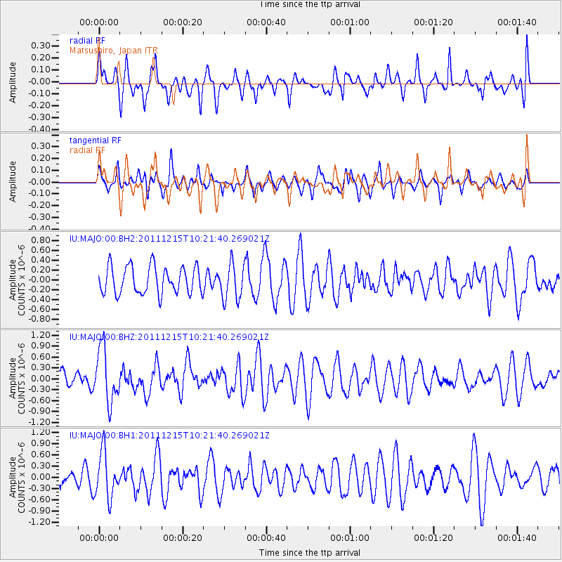
MAJO Matsushiro, Japan - Earthquake Result Viewer
*The percent match for this event was below the threshold and hence no stack was calculated.
| Earthquake location: |
South Of Kermadec Islands |
| Earthquake latitude/longitude: |
-32.7/-179.1 |
| Earthquake time(UTC): |
2011/12/15 (349) 10:10:07 GMT |
| Earthquake Depth: |
32 km |
| Earthquake Magnitude: |
5.8 MB, 5.7 MS, 6.0 MW, 5.9 MW |
| Earthquake Catalog/Contributor: |
WHDF/NEIC |
|
| Network: |
IU Global Seismograph Network (GSN - IRIS/USGS) |
| Station: |
MAJO Matsushiro, Japan |
| Lat/Lon: |
36.55 N/138.20 E |
| Elevation: |
405 m |
|
| Distance: |
79.6 deg |
| Az: |
326.279 deg |
| Baz: |
144.469 deg |
| Ray Param: |
$rayparam |
*The percent match for this event was below the threshold and hence was not used in the summary stack. |
|
| Radial Match: |
52.52553 % |
| Radial Bump: |
400 |
| Transverse Match: |
41.370884 % |
| Transverse Bump: |
348 |
| SOD ConfigId: |
558545 |
| Insert Time: |
2013-09-19 08:36:21.086 +0000 |
| GWidth: |
2.5 |
| Max Bumps: |
400 |
| Tol: |
0.001 |
|
Signal To Noise
| Channel | StoN | STA | LTA |
| IU:MAJO:00:BHZ:20111215T10:21:40.269021Z | 3.006803 | 7.482288E-7 | 2.488453E-7 |
| IU:MAJO:00:BH1:20111215T10:21:40.269021Z | 2.2127814 | 6.1237364E-7 | 2.7674383E-7 |
| IU:MAJO:00:BH2:20111215T10:21:40.269021Z | 1.3542259 | 3.7363054E-7 | 2.7589974E-7 |
| Arrivals |
| Ps | |
| PpPs | |
| PsPs/PpSs | |


