You are here: Home > Network List > II - Global Seismograph Network (GSN - IRIS/IDA) Stations List
> Station WRAB Tennant Creek, NT, Australia > Earthquake Result Viewer
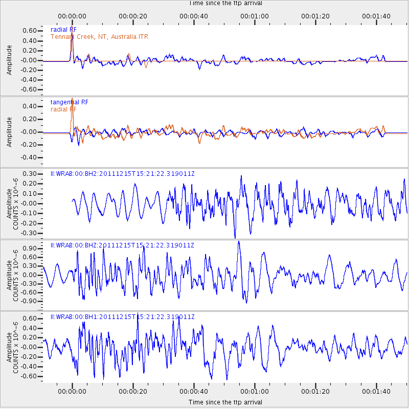
WRAB Tennant Creek, NT, Australia - Earthquake Result Viewer
*The percent match for this event was below the threshold and hence no stack was calculated.
| Earthquake location: |
Southeast Of Honshu, Japan |
| Earthquake latitude/longitude: |
31.7/141.6 |
| Earthquake time(UTC): |
2011/12/15 (349) 15:12:48 GMT |
| Earthquake Depth: |
35 km |
| Earthquake Magnitude: |
5.6 MW, 5.5 MS, 5.6 MW |
| Earthquake Catalog/Contributor: |
NEIC PDE/NEIC PDE-M |
|
| Network: |
II Global Seismograph Network (GSN - IRIS/IDA) |
| Station: |
WRAB Tennant Creek, NT, Australia |
| Lat/Lon: |
19.93 S/134.36 E |
| Elevation: |
366 m |
|
| Distance: |
51.8 deg |
| Az: |
188.712 deg |
| Baz: |
7.886 deg |
| Ray Param: |
$rayparam |
*The percent match for this event was below the threshold and hence was not used in the summary stack. |
|
| Radial Match: |
66.58216 % |
| Radial Bump: |
400 |
| Transverse Match: |
63.517536 % |
| Transverse Bump: |
400 |
| SOD ConfigId: |
558545 |
| Insert Time: |
2013-09-19 08:38:59.967 +0000 |
| GWidth: |
2.5 |
| Max Bumps: |
400 |
| Tol: |
0.001 |
|
Signal To Noise
| Channel | StoN | STA | LTA |
| II:WRAB:00:BHZ:20111215T15:21:22.319011Z | 2.2102728 | 3.9507225E-7 | 1.7874366E-7 |
| II:WRAB:00:BH1:20111215T15:21:22.319011Z | 2.3814566 | 2.9853896E-7 | 1.253598E-7 |
| II:WRAB:00:BH2:20111215T15:21:22.319011Z | 1.1100539 | 1.0173299E-7 | 9.164689E-8 |
| Arrivals |
| Ps | |
| PpPs | |
| PsPs/PpSs | |


