You are here: Home > Network List > IU - Global Seismograph Network (GSN - IRIS/USGS) Stations List
> Station PMG Port Moresby, New Guinea > Earthquake Result Viewer
PMG Port Moresby, New Guinea - Earthquake Result Viewer
*The percent match for this event was below the threshold and hence no stack was calculated.
| Earthquake location: |
Southeast Of Honshu, Japan |
| Earthquake latitude/longitude: |
31.7/141.6 |
| Earthquake time(UTC): |
2011/12/15 (349) 15:12:48 GMT |
| Earthquake Depth: |
35 km |
| Earthquake Magnitude: |
5.6 MW, 5.5 MS, 5.6 MW |
| Earthquake Catalog/Contributor: |
NEIC PDE/NEIC PDE-M |
|
| Network: |
IU Global Seismograph Network (GSN - IRIS/USGS) |
| Station: |
PMG Port Moresby, New Guinea |
| Lat/Lon: |
9.40 S/147.16 E |
| Elevation: |
90 m |
|
| Distance: |
41.2 deg |
| Az: |
171.707 deg |
| Baz: |
352.843 deg |
| Ray Param: |
$rayparam |
*The percent match for this event was below the threshold and hence was not used in the summary stack. |
|
| Radial Match: |
75.14133 % |
| Radial Bump: |
400 |
| Transverse Match: |
66.33772 % |
| Transverse Bump: |
400 |
| SOD ConfigId: |
558545 |
| Insert Time: |
2013-09-19 08:39:36.487 +0000 |
| GWidth: |
2.5 |
| Max Bumps: |
400 |
| Tol: |
0.001 |
|
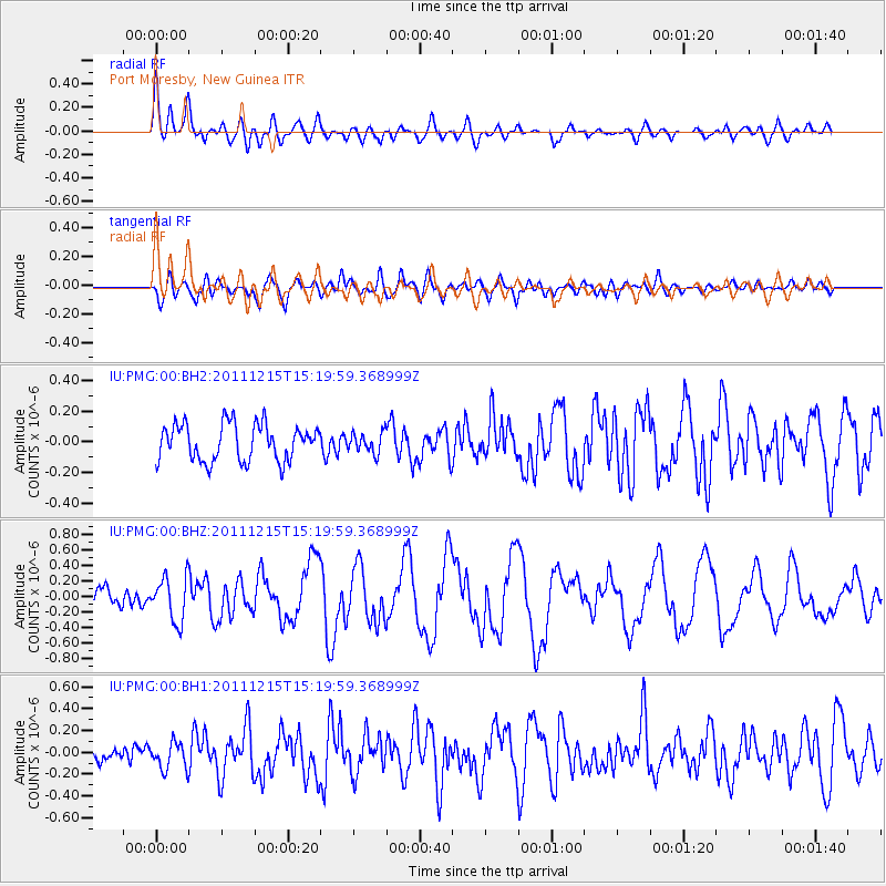
Signal To Noise
| Channel | StoN | STA | LTA |
| IU:PMG:00:BHZ:20111215T15:19:59.368999Z | 2.2860167 | 2.837341E-7 | 1.2411725E-7 |
| IU:PMG:00:BH1:20111215T15:19:59.368999Z | 1.6400068 | 1.2372446E-7 | 7.5441434E-8 |
| IU:PMG:00:BH2:20111215T15:19:59.368999Z | 0.55011475 | 6.552201E-8 | 1.1910608E-7 |
| Arrivals |
| Ps | |
| PpPs | |
| PsPs/PpSs | |


