You are here: Home > Network List > AV - Alaska Volcano Observatory Stations List
> Station MAPS Pakushin Southeast, Makushin Volcano, Alaska > Earthquake Result Viewer
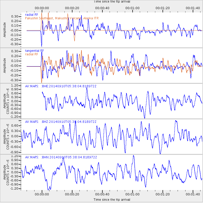
MAPS Pakushin Southeast, Makushin Volcano, Alaska - Earthquake Result Viewer
*The percent match for this event was below the threshold and hence no stack was calculated.
| Earthquake location: |
Iceland |
| Earthquake latitude/longitude: |
64.7/-17.5 |
| Earthquake time(UTC): |
2014/09/10 (253) 05:28:31 GMT |
| Earthquake Depth: |
3.6 km |
| Earthquake Magnitude: |
5.2 MW |
| Earthquake Catalog/Contributor: |
ISC/ISC |
|
| Network: |
AV Alaska Volcano Observatory |
| Station: |
MAPS Pakushin Southeast, Makushin Volcano, Alaska |
| Lat/Lon: |
53.81 N/166.94 W |
| Elevation: |
333 m |
|
| Distance: |
59.5 deg |
| Az: |
339.51 deg |
| Baz: |
14.703 deg |
| Ray Param: |
$rayparam |
*The percent match for this event was below the threshold and hence was not used in the summary stack. |
|
| Radial Match: |
42.424957 % |
| Radial Bump: |
400 |
| Transverse Match: |
61.894783 % |
| Transverse Bump: |
400 |
| SOD ConfigId: |
3390531 |
| Insert Time: |
2019-04-13 23:15:58.586 +0000 |
| GWidth: |
2.5 |
| Max Bumps: |
400 |
| Tol: |
0.001 |
|
Signal To Noise
| Channel | StoN | STA | LTA |
| AV:MAPS: :BHZ:20140910T05:38:04.818972Z | 1.0122538 | 3.256939E-7 | 3.2175126E-7 |
| AV:MAPS: :BHN:20140910T05:38:04.818972Z | 2.6732862 | 6.959937E-7 | 2.6035138E-7 |
| AV:MAPS: :BHE:20140910T05:38:04.818972Z | 1.4326137 | 4.774188E-7 | 3.3325017E-7 |
| Arrivals |
| Ps | |
| PpPs | |
| PsPs/PpSs | |


