You are here: Home > Network List > IU - Global Seismograph Network (GSN - IRIS/USGS) Stations List
> Station HNR Honiara, Solomon Islands > Earthquake Result Viewer
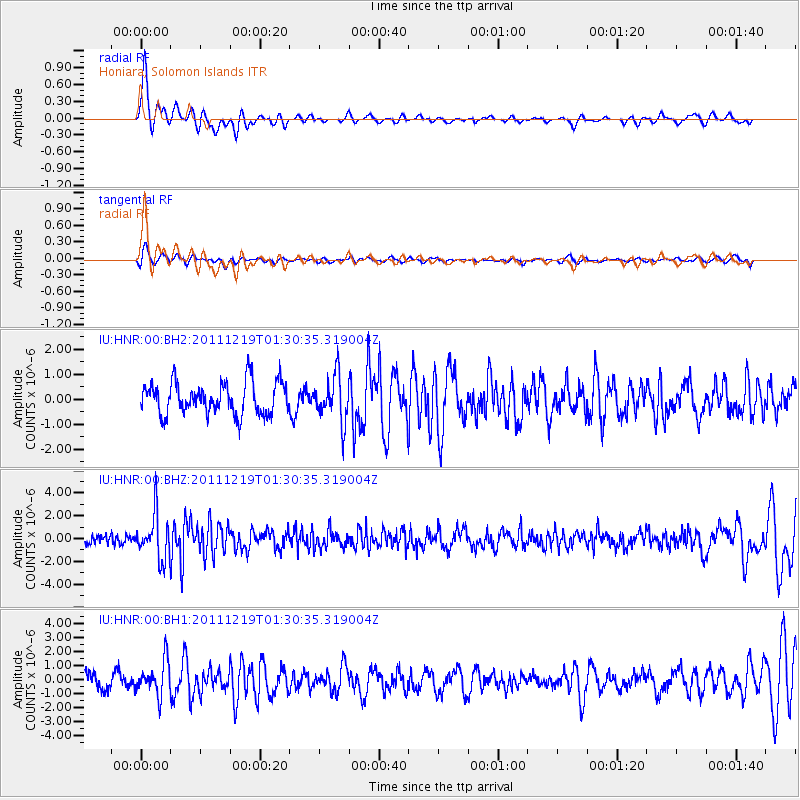
HNR Honiara, Solomon Islands - Earthquake Result Viewer
*The percent match for this event was below the threshold and hence no stack was calculated.
| Earthquake location: |
Sulawesi, Indonesia |
| Earthquake latitude/longitude: |
-1.3/119.6 |
| Earthquake time(UTC): |
2011/12/19 (353) 01:23:23 GMT |
| Earthquake Depth: |
10 km |
| Earthquake Magnitude: |
5.6 MB, 5.2 MS, 5.7 MW, 5.7 MW |
| Earthquake Catalog/Contributor: |
WHDF/NEIC |
|
| Network: |
IU Global Seismograph Network (GSN - IRIS/USGS) |
| Station: |
HNR Honiara, Solomon Islands |
| Lat/Lon: |
9.44 S/159.95 E |
| Elevation: |
100 m |
|
| Distance: |
40.9 deg |
| Az: |
102.917 deg |
| Baz: |
279.012 deg |
| Ray Param: |
$rayparam |
*The percent match for this event was below the threshold and hence was not used in the summary stack. |
|
| Radial Match: |
77.84282 % |
| Radial Bump: |
371 |
| Transverse Match: |
52.39695 % |
| Transverse Bump: |
400 |
| SOD ConfigId: |
558545 |
| Insert Time: |
2013-09-19 08:44:52.181 +0000 |
| GWidth: |
2.5 |
| Max Bumps: |
400 |
| Tol: |
0.001 |
|
Signal To Noise
| Channel | StoN | STA | LTA |
| IU:HNR:00:BHZ:20111219T01:30:35.319004Z | 4.322249 | 2.0022142E-6 | 4.6323436E-7 |
| IU:HNR:00:BH1:20111219T01:30:35.319004Z | 2.462998 | 1.19982E-6 | 4.8713804E-7 |
| IU:HNR:00:BH2:20111219T01:30:35.319004Z | 1.4139467 | 9.1051413E-7 | 6.4395215E-7 |
| Arrivals |
| Ps | |
| PpPs | |
| PsPs/PpSs | |


