You are here: Home > Network List > US - United States National Seismic Network Stations List
> Station MSO Missoula, Montana, USA > Earthquake Result Viewer
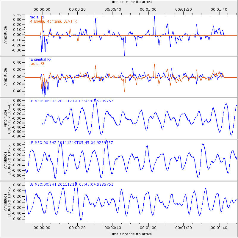
MSO Missoula, Montana, USA - Earthquake Result Viewer
*The percent match for this event was below the threshold and hence no stack was calculated.
| Earthquake location: |
Kermadec Islands Region |
| Earthquake latitude/longitude: |
-29.1/-176.9 |
| Earthquake time(UTC): |
2011/12/19 (353) 05:32:16 GMT |
| Earthquake Depth: |
10 km |
| Earthquake Magnitude: |
5.7 MW, 5.5 MW |
| Earthquake Catalog/Contributor: |
NEIC PDE/NEIC PDE-M |
|
| Network: |
US United States National Seismic Network |
| Station: |
MSO Missoula, Montana, USA |
| Lat/Lon: |
46.83 N/113.94 W |
| Elevation: |
1264 m |
|
| Distance: |
94.5 deg |
| Az: |
37.823 deg |
| Baz: |
231.426 deg |
| Ray Param: |
$rayparam |
*The percent match for this event was below the threshold and hence was not used in the summary stack. |
|
| Radial Match: |
65.62979 % |
| Radial Bump: |
400 |
| Transverse Match: |
64.47726 % |
| Transverse Bump: |
400 |
| SOD ConfigId: |
558545 |
| Insert Time: |
2013-09-19 08:48:44.986 +0000 |
| GWidth: |
2.5 |
| Max Bumps: |
400 |
| Tol: |
0.001 |
|
Signal To Noise
| Channel | StoN | STA | LTA |
| US:MSO:00:BHZ:20111219T05:45:04.923975Z | 0.6479734 | 1.8392339E-7 | 2.8384403E-7 |
| US:MSO:00:BH1:20111219T05:45:04.923975Z | 0.86529386 | 2.6593585E-7 | 3.0733588E-7 |
| US:MSO:00:BH2:20111219T05:45:04.923975Z | 2.5013473 | 5.961219E-7 | 2.3832031E-7 |
| Arrivals |
| Ps | |
| PpPs | |
| PsPs/PpSs | |


