LLLB LILLOOET, BC, CANADA ADA - Earthquake Result Viewer
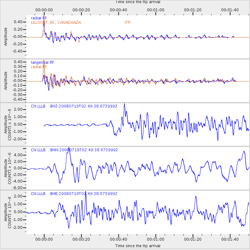
Earthquake location: Off East Coast Of Honshu, Japan
Earthquake latitude/longitude: 37.6/142.2
Earthquake time(UTC): 2008/07/19 (201) 02:39:28 GMT
Earthquake Depth: 22 km
Earthquake Magnitude: 6.2 MB, 7.0 MS, 7.0 MW, 6.9 MW
Earthquake Catalog/Contributor: WHDF/NEIC
Network: CN Canadian National Seismograph Network
Station: LLLB LILLOOET, BC, CANADA ADA
Lat/Lon: 50.61 N/121.88 W
Elevation: 700 m
Distance: 65.4 deg
Az: 44.173 deg
Baz: 299.633 deg
Ray Param: 0.05824551
Estimated Moho Depth: 10.25 km
Estimated Crust Vp/Vs: 1.70
Assumed Crust Vp: 6.597 km/s
Estimated Crust Vs: 3.881 km/s
Estimated Crust Poisson's Ratio: 0.24
Radial Match: 88.3802 %
Radial Bump: 400
Transverse Match: 79.83252 %
Transverse Bump: 400
SOD ConfigId: 2504
Insert Time: 2010-02-27 06:38:00.712 +0000
GWidth: 2.5
Max Bumps: 400
Tol: 0.001

Signal To Noise

ChannelStoNSTALTA
CN:LLLB: :BHN:20080719T02:49:38.673999Z6.1519574.4393659E-77.2161846E-8
CN:LLLB: :BHE:20080719T02:49:38.673999Z2.6851211.3586782E-75.0600256E-8
CN:LLLB: :BHZ:20080719T02:49:38.673999Z1.50495841.0036278E-76.6688074E-8
Arrivals
Ps1.1 SECOND
PpPs4.0 SECOND
PsPs/PpSs5.1 SECOND