You are here: Home > Network List > IU - Global Seismograph Network (GSN - IRIS/USGS) Stations List
> Station HNR Honiara, Solomon Islands > Earthquake Result Viewer
HNR Honiara, Solomon Islands - Earthquake Result Viewer
*The percent match for this event was below the threshold and hence no stack was calculated.
| Earthquake location: |
South Of Kermadec Islands |
| Earthquake latitude/longitude: |
-33.8/-178.3 |
| Earthquake time(UTC): |
2011/12/23 (357) 10:52:07 GMT |
| Earthquake Depth: |
10 km |
| Earthquake Magnitude: |
5.7 MB |
| Earthquake Catalog/Contributor: |
NEIC PDE/NEIC PDE-M |
|
| Network: |
IU Global Seismograph Network (GSN - IRIS/USGS) |
| Station: |
HNR Honiara, Solomon Islands |
| Lat/Lon: |
9.44 S/159.95 E |
| Elevation: |
100 m |
|
| Distance: |
31.4 deg |
| Az: |
315.558 deg |
| Baz: |
143.784 deg |
| Ray Param: |
$rayparam |
*The percent match for this event was below the threshold and hence was not used in the summary stack. |
|
| Radial Match: |
63.813328 % |
| Radial Bump: |
400 |
| Transverse Match: |
61.247013 % |
| Transverse Bump: |
400 |
| SOD ConfigId: |
558545 |
| Insert Time: |
2013-09-19 08:58:44.578 +0000 |
| GWidth: |
2.5 |
| Max Bumps: |
400 |
| Tol: |
0.001 |
|
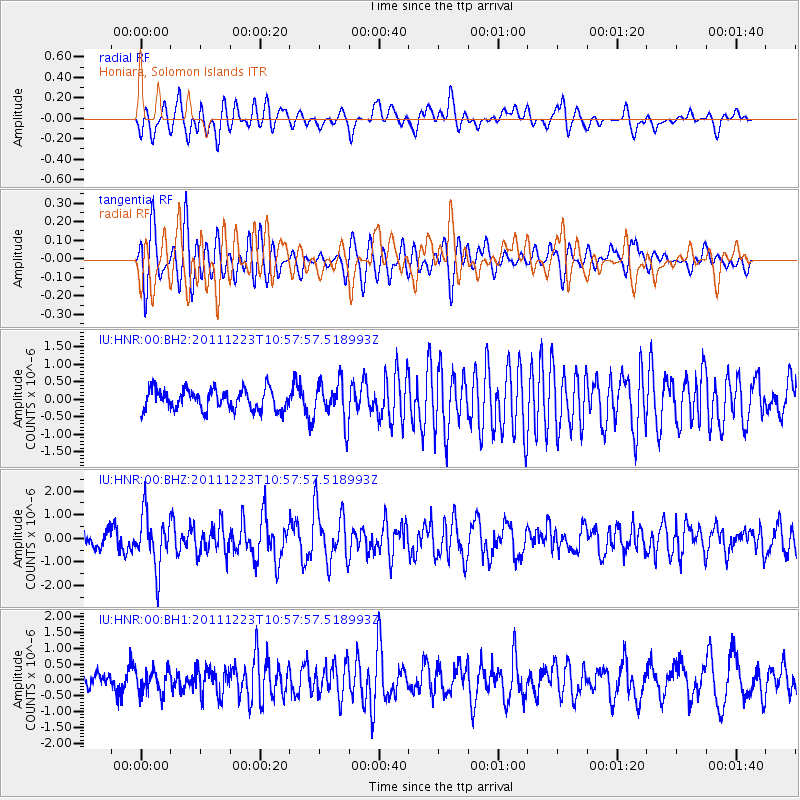
Signal To Noise
| Channel | StoN | STA | LTA |
| IU:HNR:00:BHZ:20111223T10:57:57.518993Z | 3.4251673 | 1.1409032E-6 | 3.330942E-7 |
| IU:HNR:00:BH1:20111223T10:57:57.518993Z | 1.4810942 | 3.7629755E-7 | 2.5406726E-7 |
| IU:HNR:00:BH2:20111223T10:57:57.518993Z | 1.9353771 | 5.691433E-7 | 2.940736E-7 |
| Arrivals |
| Ps | |
| PpPs | |
| PsPs/PpSs | |


