You are here: Home > Network List > US - United States National Seismic Network Stations List
> Station MNTX Cornudas Mountains, Texas, USA > Earthquake Result Viewer
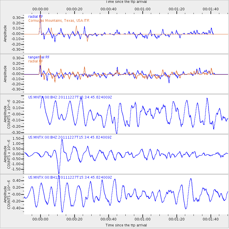
MNTX Cornudas Mountains, Texas, USA - Earthquake Result Viewer
*The percent match for this event was below the threshold and hence no stack was calculated.
| Earthquake location: |
Southwestern Siberia, Russia |
| Earthquake latitude/longitude: |
51.8/95.9 |
| Earthquake time(UTC): |
2011/12/27 (361) 15:21:56 GMT |
| Earthquake Depth: |
15 km |
| Earthquake Magnitude: |
6.1 MB, 6.7 MS, 6.6 MW, 6.6 MW |
| Earthquake Catalog/Contributor: |
WHDF/NEIC |
|
| Network: |
US United States National Seismic Network |
| Station: |
MNTX Cornudas Mountains, Texas, USA |
| Lat/Lon: |
31.70 N/105.38 W |
| Elevation: |
404 m |
|
| Distance: |
94.7 deg |
| Az: |
18.095 deg |
| Baz: |
346.935 deg |
| Ray Param: |
$rayparam |
*The percent match for this event was below the threshold and hence was not used in the summary stack. |
|
| Radial Match: |
74.56063 % |
| Radial Bump: |
331 |
| Transverse Match: |
65.95816 % |
| Transverse Bump: |
400 |
| SOD ConfigId: |
558545 |
| Insert Time: |
2013-09-19 09:10:24.909 +0000 |
| GWidth: |
2.5 |
| Max Bumps: |
400 |
| Tol: |
0.001 |
|
Signal To Noise
| Channel | StoN | STA | LTA |
| US:MNTX:00:BHZ:20111227T15:34:45.824009Z | 1.3423051 | 1.8397114E-7 | 1.3705613E-7 |
| US:MNTX:00:BH1:20111227T15:34:45.824009Z | 2.0540044 | 2.1445727E-7 | 1.0440936E-7 |
| US:MNTX:00:BH2:20111227T15:34:45.824009Z | 0.5849423 | 7.912871E-8 | 1.352761E-7 |
| Arrivals |
| Ps | |
| PpPs | |
| PsPs/PpSs | |


