You are here: Home > Network List > US - United States National Seismic Network Stations List
> Station EGMT Eagleton, Montana, USA > Earthquake Result Viewer
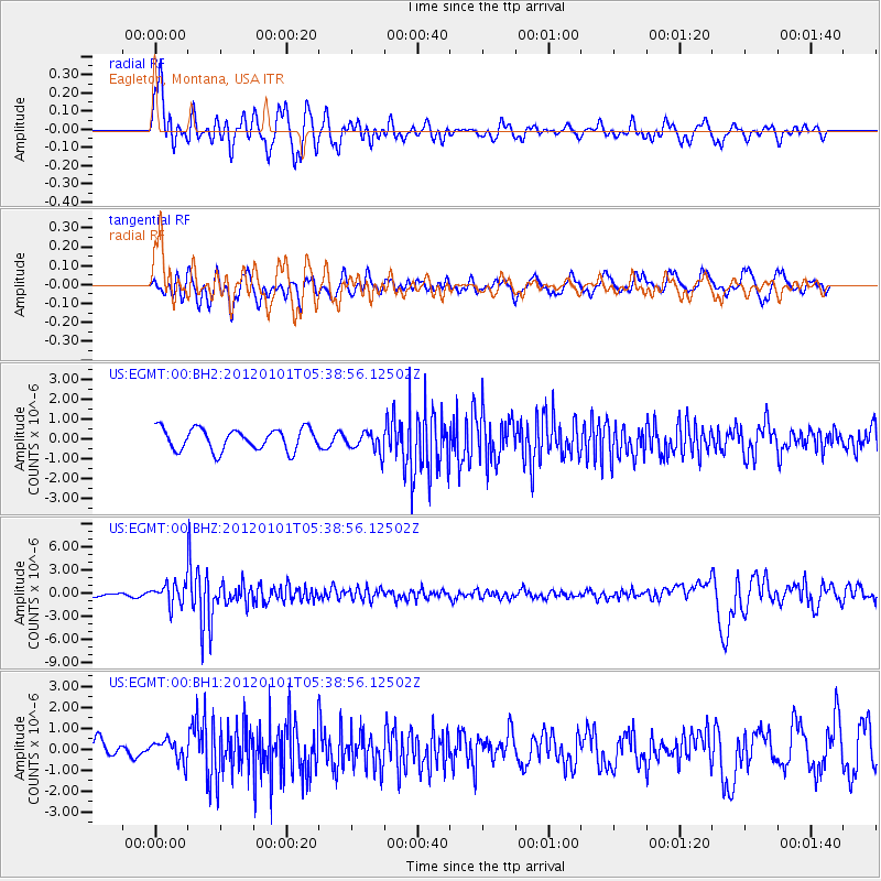
EGMT Eagleton, Montana, USA - Earthquake Result Viewer
*The percent match for this event was below the threshold and hence no stack was calculated.
| Earthquake location: |
Southeast Of Honshu, Japan |
| Earthquake latitude/longitude: |
31.5/138.1 |
| Earthquake time(UTC): |
2012/01/01 (001) 05:27:55 GMT |
| Earthquake Depth: |
365 km |
| Earthquake Magnitude: |
6.2 MB, 6.8 MW, 6.8 MW |
| Earthquake Catalog/Contributor: |
WHDF/NEIC |
|
| Network: |
US United States National Seismic Network |
| Station: |
EGMT Eagleton, Montana, USA |
| Lat/Lon: |
48.02 N/109.75 W |
| Elevation: |
1055 m |
|
| Distance: |
80.3 deg |
| Az: |
39.099 deg |
| Baz: |
306.596 deg |
| Ray Param: |
$rayparam |
*The percent match for this event was below the threshold and hence was not used in the summary stack. |
|
| Radial Match: |
76.88178 % |
| Radial Bump: |
400 |
| Transverse Match: |
61.617607 % |
| Transverse Bump: |
400 |
| SOD ConfigId: |
558545 |
| Insert Time: |
2013-09-19 09:17:28.531 +0000 |
| GWidth: |
2.5 |
| Max Bumps: |
400 |
| Tol: |
0.001 |
|
Signal To Noise
| Channel | StoN | STA | LTA |
| US:EGMT:00:BHZ:20120101T05:38:56.12502Z | 6.657912 | 1.3681072E-6 | 2.0548593E-7 |
| US:EGMT:00:BH1:20120101T05:38:56.12502Z | 1.0821558 | 5.2327135E-7 | 4.835453E-7 |
| US:EGMT:00:BH2:20120101T05:38:56.12502Z | 0.97356415 | 5.297948E-7 | 5.441807E-7 |
| Arrivals |
| Ps | |
| PpPs | |
| PsPs/PpSs | |


