You are here: Home > Network List > G - GEOSCOPE Stations List
> Station KIP Kipapa - Hawaii, USA > Earthquake Result Viewer
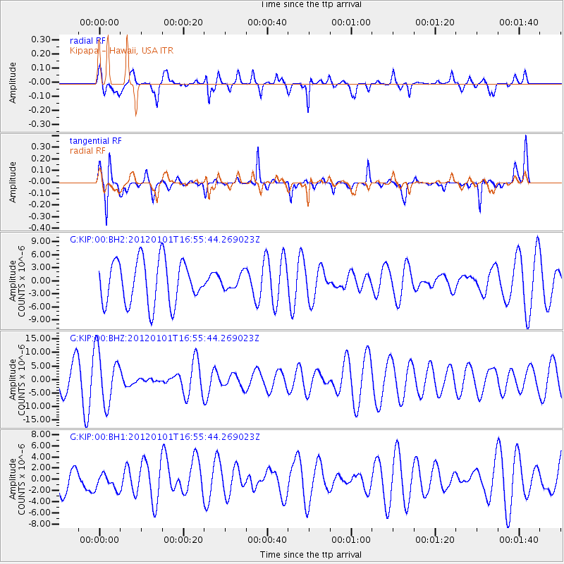
KIP Kipapa - Hawaii, USA - Earthquake Result Viewer
*The percent match for this event was below the threshold and hence no stack was calculated.
| Earthquake location: |
South Island, New Zealand |
| Earthquake latitude/longitude: |
-43.5/172.9 |
| Earthquake time(UTC): |
2012/01/01 (001) 16:45:05 GMT |
| Earthquake Depth: |
14 km |
| Earthquake Magnitude: |
5.5 ML |
| Earthquake Catalog/Contributor: |
NEIC PDE/NEIC PDE-M |
|
| Network: |
G GEOSCOPE |
| Station: |
KIP Kipapa - Hawaii, USA |
| Lat/Lon: |
21.42 N/158.01 W |
| Elevation: |
70 m |
|
| Distance: |
69.9 deg |
| Az: |
28.854 deg |
| Baz: |
202.151 deg |
| Ray Param: |
$rayparam |
*The percent match for this event was below the threshold and hence was not used in the summary stack. |
|
| Radial Match: |
56.52615 % |
| Radial Bump: |
400 |
| Transverse Match: |
54.15432 % |
| Transverse Bump: |
262 |
| SOD ConfigId: |
558545 |
| Insert Time: |
2013-09-19 09:18:43.776 +0000 |
| GWidth: |
2.5 |
| Max Bumps: |
400 |
| Tol: |
0.001 |
|
Signal To Noise
| Channel | StoN | STA | LTA |
| G:KIP:00:BHZ:20120101T16:55:44.269023Z | 1.6903437 | 9.452273E-6 | 5.5919236E-6 |
| G:KIP:00:BH1:20120101T16:55:44.269023Z | 0.54830325 | 1.3577655E-6 | 2.4763042E-6 |
| G:KIP:00:BH2:20120101T16:55:44.269023Z | 0.3479018 | 1.7650744E-6 | 5.0734848E-6 |
| Arrivals |
| Ps | |
| PpPs | |
| PsPs/PpSs | |


