You are here: Home > Network List > II - Global Seismograph Network (GSN - IRIS/IDA) Stations List
> Station WRAB Tennant Creek, NT, Australia > Earthquake Result Viewer
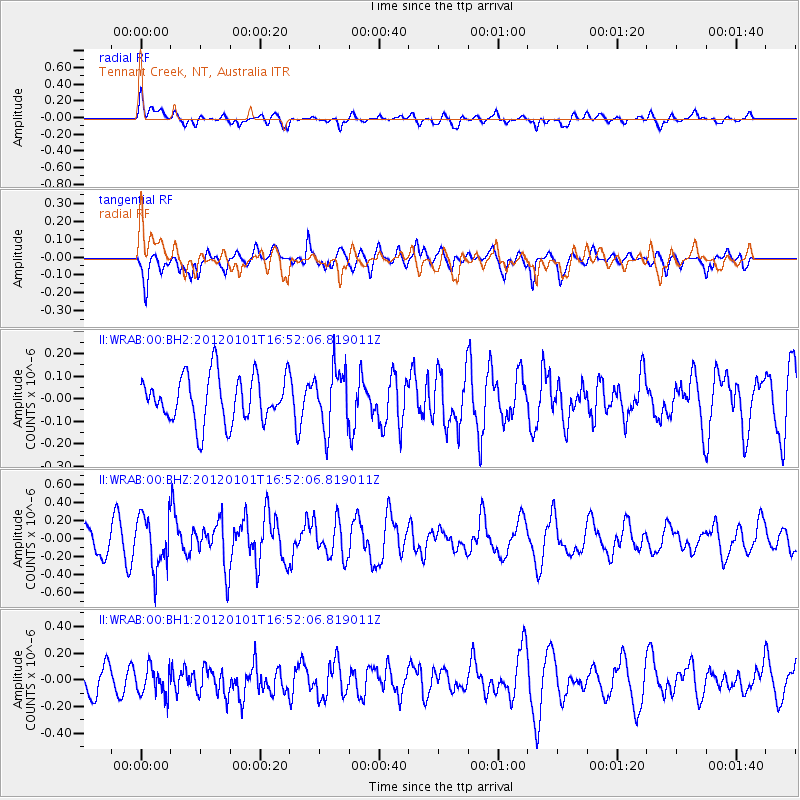
WRAB Tennant Creek, NT, Australia - Earthquake Result Viewer
*The percent match for this event was below the threshold and hence no stack was calculated.
| Earthquake location: |
South Island, New Zealand |
| Earthquake latitude/longitude: |
-43.5/172.9 |
| Earthquake time(UTC): |
2012/01/01 (001) 16:45:05 GMT |
| Earthquake Depth: |
14 km |
| Earthquake Magnitude: |
5.5 ML |
| Earthquake Catalog/Contributor: |
NEIC PDE/NEIC PDE-M |
|
| Network: |
II Global Seismograph Network (GSN - IRIS/IDA) |
| Station: |
WRAB Tennant Creek, NT, Australia |
| Lat/Lon: |
19.93 S/134.36 E |
| Elevation: |
366 m |
|
| Distance: |
39.8 deg |
| Az: |
293.76 deg |
| Baz: |
134.914 deg |
| Ray Param: |
$rayparam |
*The percent match for this event was below the threshold and hence was not used in the summary stack. |
|
| Radial Match: |
59.256374 % |
| Radial Bump: |
400 |
| Transverse Match: |
57.92447 % |
| Transverse Bump: |
400 |
| SOD ConfigId: |
558545 |
| Insert Time: |
2013-09-19 09:18:53.461 +0000 |
| GWidth: |
2.5 |
| Max Bumps: |
400 |
| Tol: |
0.001 |
|
Signal To Noise
| Channel | StoN | STA | LTA |
| II:WRAB:00:BHZ:20120101T16:52:06.819011Z | 2.6688743 | 2.9501635E-7 | 1.1053962E-7 |
| II:WRAB:00:BH1:20120101T16:52:06.819011Z | 1.050227 | 1.073872E-7 | 1.0225141E-7 |
| II:WRAB:00:BH2:20120101T16:52:06.819011Z | 1.295423 | 1.3304377E-7 | 1.0270295E-7 |
| Arrivals |
| Ps | |
| PpPs | |
| PsPs/PpSs | |


