You are here: Home > Network List > US - United States National Seismic Network Stations List
> Station MIAR Mount Ida, Arkansas, USA > Earthquake Result Viewer
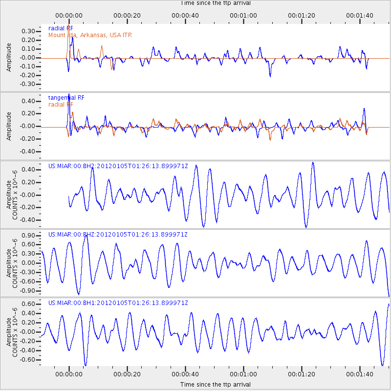
MIAR Mount Ida, Arkansas, USA - Earthquake Result Viewer
*The percent match for this event was below the threshold and hence no stack was calculated.
| Earthquake location: |
Tonga Islands |
| Earthquake latitude/longitude: |
-17.7/-173.5 |
| Earthquake time(UTC): |
2012/01/05 (005) 01:13:40 GMT |
| Earthquake Depth: |
35 km |
| Earthquake Magnitude: |
5.6 MW |
| Earthquake Catalog/Contributor: |
NEIC PDE/NEIC PDE-M |
|
| Network: |
US United States National Seismic Network |
| Station: |
MIAR Mount Ida, Arkansas, USA |
| Lat/Lon: |
34.55 N/93.58 W |
| Elevation: |
207 m |
|
| Distance: |
91.9 deg |
| Az: |
54.418 deg |
| Baz: |
249.924 deg |
| Ray Param: |
$rayparam |
*The percent match for this event was below the threshold and hence was not used in the summary stack. |
|
| Radial Match: |
65.27353 % |
| Radial Bump: |
400 |
| Transverse Match: |
55.21431 % |
| Transverse Bump: |
399 |
| SOD ConfigId: |
558545 |
| Insert Time: |
2013-09-19 09:22:13.591 +0000 |
| GWidth: |
2.5 |
| Max Bumps: |
400 |
| Tol: |
0.001 |
|
Signal To Noise
| Channel | StoN | STA | LTA |
| US:MIAR:00:BHZ:20120105T01:26:13.899971Z | 2.344249 | 6.0210726E-7 | 2.568444E-7 |
| US:MIAR:00:BH1:20120105T01:26:13.899971Z | 1.8009858 | 2.719953E-7 | 1.510258E-7 |
| US:MIAR:00:BH2:20120105T01:26:13.899971Z | 0.78255045 | 1.1119046E-7 | 1.4208727E-7 |
| Arrivals |
| Ps | |
| PpPs | |
| PsPs/PpSs | |


