You are here: Home > Network List > TA - USArray Transportable Network (new EarthScope stations) Stations List
> Station M51A Elyria, OH, USA > Earthquake Result Viewer
M51A Elyria, OH, USA - Earthquake Result Viewer
*The percent match for this event was below the threshold and hence no stack was calculated.
| Earthquake location: |
Iceland |
| Earthquake latitude/longitude: |
64.7/-17.5 |
| Earthquake time(UTC): |
2014/09/10 (253) 05:28:31 GMT |
| Earthquake Depth: |
3.6 km |
| Earthquake Magnitude: |
5.2 MW |
| Earthquake Catalog/Contributor: |
ISC/ISC |
|
| Network: |
TA USArray Transportable Network (new EarthScope stations) |
| Station: |
M51A Elyria, OH, USA |
| Lat/Lon: |
41.33 N/82.18 W |
| Elevation: |
239 m |
|
| Distance: |
42.9 deg |
| Az: |
269.331 deg |
| Baz: |
34.82 deg |
| Ray Param: |
$rayparam |
*The percent match for this event was below the threshold and hence was not used in the summary stack. |
|
| Radial Match: |
68.67077 % |
| Radial Bump: |
400 |
| Transverse Match: |
49.36836 % |
| Transverse Bump: |
400 |
| SOD ConfigId: |
3390531 |
| Insert Time: |
2019-04-13 23:21:23.649 +0000 |
| GWidth: |
2.5 |
| Max Bumps: |
400 |
| Tol: |
0.001 |
|
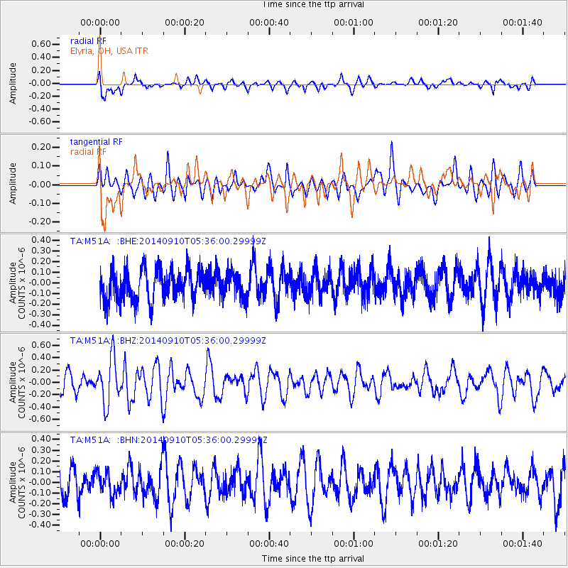
Signal To Noise
| Channel | StoN | STA | LTA |
| TA:M51A: :BHZ:20140910T05:36:00.29999Z | 1.7890047 | 3.7384658E-7 | 2.0896904E-7 |
| TA:M51A: :BHN:20140910T05:36:00.29999Z | 0.7171451 | 1.018322E-7 | 1.4199665E-7 |
| TA:M51A: :BHE:20140910T05:36:00.29999Z | 0.8230276 | 1.2106813E-7 | 1.4710092E-7 |
| Arrivals |
| Ps | |
| PpPs | |
| PsPs/PpSs | |


