You are here: Home > Network List > IU - Global Seismograph Network (GSN - IRIS/USGS) Stations List
> Station RSSD Black Hills, South Dakota, USA > Earthquake Result Viewer
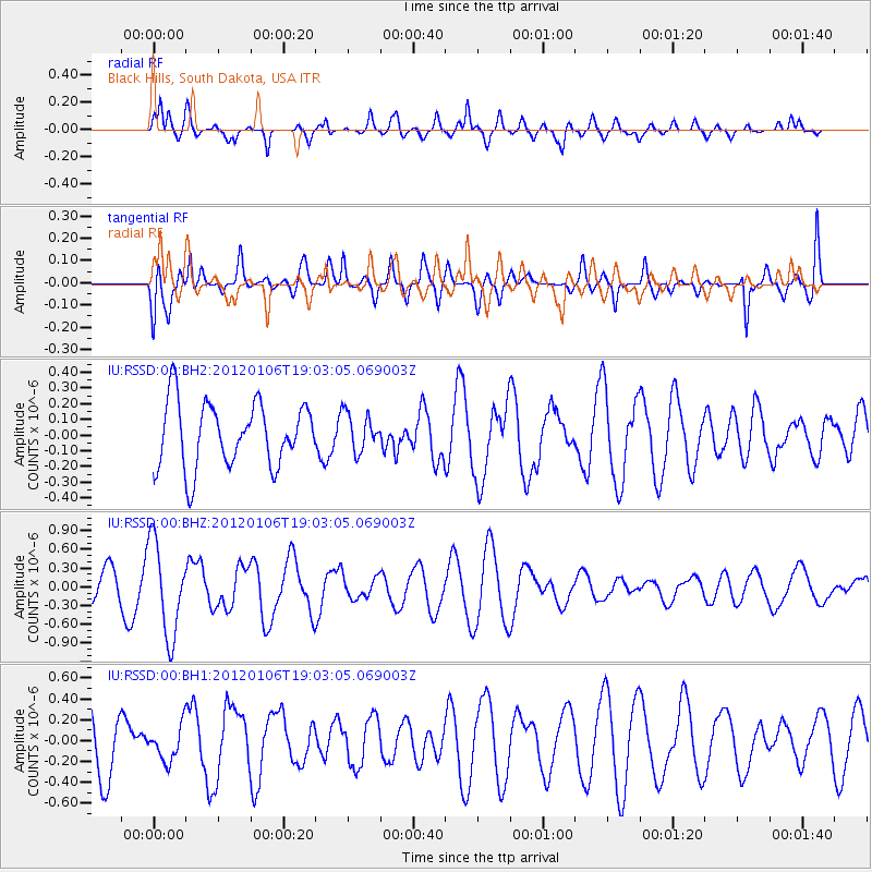
RSSD Black Hills, South Dakota, USA - Earthquake Result Viewer
*The percent match for this event was below the threshold and hence no stack was calculated.
| Earthquake location: |
Central East Pacific Rise |
| Earthquake latitude/longitude: |
-6.3/-107.3 |
| Earthquake time(UTC): |
2012/01/06 (006) 18:54:39 GMT |
| Earthquake Depth: |
10 km |
| Earthquake Magnitude: |
5.5 MW |
| Earthquake Catalog/Contributor: |
NEIC PDE/NEIC PDE-M |
|
| Network: |
IU Global Seismograph Network (GSN - IRIS/USGS) |
| Station: |
RSSD Black Hills, South Dakota, USA |
| Lat/Lon: |
44.12 N/104.04 W |
| Elevation: |
2090 m |
|
| Distance: |
50.3 deg |
| Az: |
3.066 deg |
| Baz: |
184.233 deg |
| Ray Param: |
$rayparam |
*The percent match for this event was below the threshold and hence was not used in the summary stack. |
|
| Radial Match: |
63.371613 % |
| Radial Bump: |
400 |
| Transverse Match: |
51.604607 % |
| Transverse Bump: |
400 |
| SOD ConfigId: |
558545 |
| Insert Time: |
2013-09-19 09:27:08.269 +0000 |
| GWidth: |
2.5 |
| Max Bumps: |
400 |
| Tol: |
0.001 |
|
Signal To Noise
| Channel | StoN | STA | LTA |
| IU:RSSD:00:BHZ:20120106T19:03:05.069003Z | 3.2118065 | 7.4761255E-7 | 2.327701E-7 |
| IU:RSSD:00:BH1:20120106T19:03:05.069003Z | 0.669108 | 1.6448152E-7 | 2.4582206E-7 |
| IU:RSSD:00:BH2:20120106T19:03:05.069003Z | 0.5820451 | 1.1992852E-7 | 2.0604678E-7 |
| Arrivals |
| Ps | |
| PpPs | |
| PsPs/PpSs | |


