You are here: Home > Network List > TA - USArray Transportable Network (new EarthScope stations) Stations List
> Station R11A Troy Canyon, Currant, NV, USA > Earthquake Result Viewer
R11A Troy Canyon, Currant, NV, USA - Earthquake Result Viewer
*The percent match for this event was below the threshold and hence no stack was calculated.
| Earthquake location: |
Iceland |
| Earthquake latitude/longitude: |
64.7/-17.5 |
| Earthquake time(UTC): |
2014/09/10 (253) 05:28:31 GMT |
| Earthquake Depth: |
3.6 km |
| Earthquake Magnitude: |
5.2 MW |
| Earthquake Catalog/Contributor: |
ISC/ISC |
|
| Network: |
TA USArray Transportable Network (new EarthScope stations) |
| Station: |
R11A Troy Canyon, Currant, NV, USA |
| Lat/Lon: |
38.35 N/115.59 W |
| Elevation: |
1756 m |
|
| Distance: |
59.3 deg |
| Az: |
295.144 deg |
| Baz: |
29.677 deg |
| Ray Param: |
$rayparam |
*The percent match for this event was below the threshold and hence was not used in the summary stack. |
|
| Radial Match: |
66.85298 % |
| Radial Bump: |
400 |
| Transverse Match: |
62.739418 % |
| Transverse Bump: |
400 |
| SOD ConfigId: |
3390531 |
| Insert Time: |
2019-04-13 23:21:38.857 +0000 |
| GWidth: |
2.5 |
| Max Bumps: |
400 |
| Tol: |
0.001 |
|
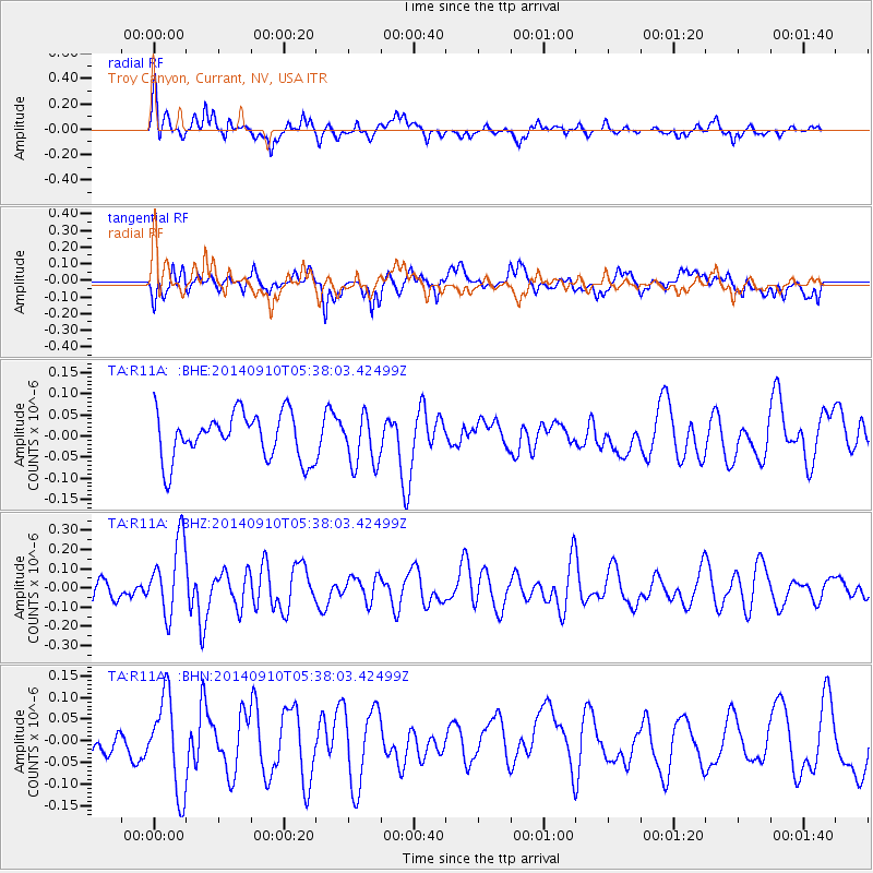
Signal To Noise
| Channel | StoN | STA | LTA |
| TA:R11A: :BHZ:20140910T05:38:03.42499Z | 2.7053754 | 1.9470075E-7 | 7.196811E-8 |
| TA:R11A: :BHN:20140910T05:38:03.42499Z | 2.3844018 | 1.0796844E-7 | 4.528114E-8 |
| TA:R11A: :BHE:20140910T05:38:03.42499Z | 1.0847027 | 5.9193816E-8 | 5.4571466E-8 |
| Arrivals |
| Ps | |
| PpPs | |
| PsPs/PpSs | |


