You are here: Home > Network List > IU - Global Seismograph Network (GSN - IRIS/USGS) Stations List
> Station RSSD Black Hills, South Dakota, USA > Earthquake Result Viewer
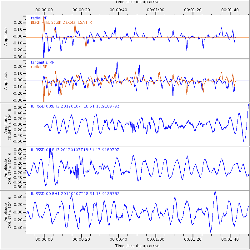
RSSD Black Hills, South Dakota, USA - Earthquake Result Viewer
*The percent match for this event was below the threshold and hence no stack was calculated.
| Earthquake location: |
Kermadec Islands Region |
| Earthquake latitude/longitude: |
-28.6/-176.9 |
| Earthquake time(UTC): |
2012/01/07 (007) 18:38:08 GMT |
| Earthquake Depth: |
10 km |
| Earthquake Magnitude: |
5.6 MW, 5.7 MW, 5.7 MB |
| Earthquake Catalog/Contributor: |
NEIC PDE/NEIC PDE-M |
|
| Network: |
IU Global Seismograph Network (GSN - IRIS/USGS) |
| Station: |
RSSD Black Hills, South Dakota, USA |
| Lat/Lon: |
44.12 N/104.04 W |
| Elevation: |
2090 m |
|
| Distance: |
98.3 deg |
| Az: |
44.078 deg |
| Baz: |
238.129 deg |
| Ray Param: |
$rayparam |
*The percent match for this event was below the threshold and hence was not used in the summary stack. |
|
| Radial Match: |
60.126965 % |
| Radial Bump: |
400 |
| Transverse Match: |
63.85505 % |
| Transverse Bump: |
400 |
| SOD ConfigId: |
558545 |
| Insert Time: |
2013-09-19 09:32:06.522 +0000 |
| GWidth: |
2.5 |
| Max Bumps: |
400 |
| Tol: |
0.001 |
|
Signal To Noise
| Channel | StoN | STA | LTA |
| IU:RSSD:00:BHZ:20120107T18:51:13.918979Z | 1.794751 | 5.358224E-7 | 2.9854968E-7 |
| IU:RSSD:00:BH1:20120107T18:51:13.918979Z | 0.7561661 | 1.6343229E-7 | 2.161328E-7 |
| IU:RSSD:00:BH2:20120107T18:51:13.918979Z | 0.88359433 | 1.724158E-7 | 1.9513003E-7 |
| Arrivals |
| Ps | |
| PpPs | |
| PsPs/PpSs | |


