You are here: Home > Network List > G - GEOSCOPE Stations List
> Station KIP Kipapa - Hawaii, USA > Earthquake Result Viewer
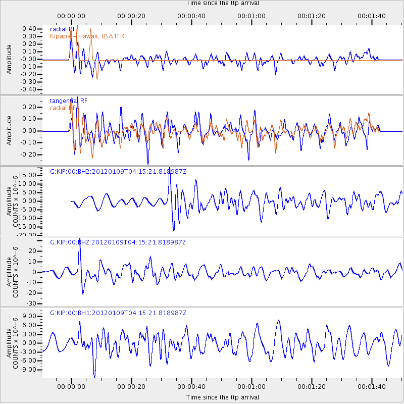
KIP Kipapa - Hawaii, USA - Earthquake Result Viewer
*The percent match for this event was below the threshold and hence no stack was calculated.
| Earthquake location: |
Santa Cruz Islands |
| Earthquake latitude/longitude: |
-10.6/165.2 |
| Earthquake time(UTC): |
2012/01/09 (009) 04:07:14 GMT |
| Earthquake Depth: |
28 km |
| Earthquake Magnitude: |
6.6 MB, 6.4 MS, 6.4 MW, 6.4 MW |
| Earthquake Catalog/Contributor: |
WHDF/NEIC |
|
| Network: |
G GEOSCOPE |
| Station: |
KIP Kipapa - Hawaii, USA |
| Lat/Lon: |
21.42 N/158.01 W |
| Elevation: |
70 m |
|
| Distance: |
48.2 deg |
| Az: |
48.532 deg |
| Baz: |
232.245 deg |
| Ray Param: |
$rayparam |
*The percent match for this event was below the threshold and hence was not used in the summary stack. |
|
| Radial Match: |
54.97292 % |
| Radial Bump: |
400 |
| Transverse Match: |
76.49614 % |
| Transverse Bump: |
400 |
| SOD ConfigId: |
558545 |
| Insert Time: |
2013-09-19 09:34:12.417 +0000 |
| GWidth: |
2.5 |
| Max Bumps: |
400 |
| Tol: |
0.001 |
|
Signal To Noise
| Channel | StoN | STA | LTA |
| G:KIP:00:BHZ:20120109T04:15:21.818987Z | 3.734383 | 1.1814327E-5 | 3.1636623E-6 |
| G:KIP:00:BH1:20120109T04:15:21.818987Z | 1.5057002 | 2.3537705E-6 | 1.5632397E-6 |
| G:KIP:00:BH2:20120109T04:15:21.818987Z | 3.5149941 | 8.2241795E-6 | 2.3397417E-6 |
| Arrivals |
| Ps | |
| PpPs | |
| PsPs/PpSs | |


