You are here: Home > Network List > US - United States National Seismic Network Stations List
> Station EGMT Eagleton, Montana, USA > Earthquake Result Viewer
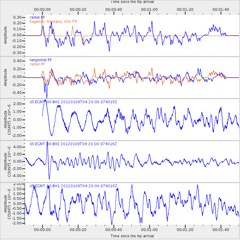
EGMT Eagleton, Montana, USA - Earthquake Result Viewer
*The percent match for this event was below the threshold and hence no stack was calculated.
| Earthquake location: |
Santa Cruz Islands |
| Earthquake latitude/longitude: |
-10.6/165.2 |
| Earthquake time(UTC): |
2012/01/09 (009) 04:07:14 GMT |
| Earthquake Depth: |
28 km |
| Earthquake Magnitude: |
6.6 MB, 6.4 MS, 6.4 MW, 6.4 MW |
| Earthquake Catalog/Contributor: |
WHDF/NEIC |
|
| Network: |
US United States National Seismic Network |
| Station: |
EGMT Eagleton, Montana, USA |
| Lat/Lon: |
48.02 N/109.75 W |
| Elevation: |
1055 m |
|
| Distance: |
94.5 deg |
| Az: |
42.139 deg |
| Baz: |
259.287 deg |
| Ray Param: |
$rayparam |
*The percent match for this event was below the threshold and hence was not used in the summary stack. |
|
| Radial Match: |
62.986244 % |
| Radial Bump: |
400 |
| Transverse Match: |
66.370674 % |
| Transverse Bump: |
400 |
| SOD ConfigId: |
558545 |
| Insert Time: |
2013-09-19 09:35:36.444 +0000 |
| GWidth: |
2.5 |
| Max Bumps: |
400 |
| Tol: |
0.001 |
|
Signal To Noise
| Channel | StoN | STA | LTA |
| US:EGMT:00:BHZ:20120109T04:20:00.974016Z | 3.573816 | 2.3523246E-6 | 6.5821087E-7 |
| US:EGMT:00:BH1:20120109T04:20:00.974016Z | 1.7477295 | 1.0793736E-6 | 6.175862E-7 |
| US:EGMT:00:BH2:20120109T04:20:00.974016Z | 0.6653483 | 7.916891E-7 | 1.1898867E-6 |
| Arrivals |
| Ps | |
| PpPs | |
| PsPs/PpSs | |


