You are here: Home > Network List > US - United States National Seismic Network Stations List
> Station HAWA Hanford, Washington, USA > Earthquake Result Viewer
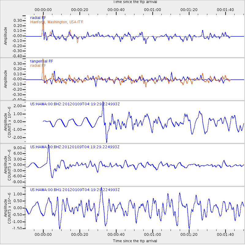
HAWA Hanford, Washington, USA - Earthquake Result Viewer
*The percent match for this event was below the threshold and hence no stack was calculated.
| Earthquake location: |
Santa Cruz Islands |
| Earthquake latitude/longitude: |
-10.6/165.2 |
| Earthquake time(UTC): |
2012/01/09 (009) 04:07:14 GMT |
| Earthquake Depth: |
28 km |
| Earthquake Magnitude: |
6.6 MB, 6.4 MS, 6.4 MW, 6.4 MW |
| Earthquake Catalog/Contributor: |
WHDF/NEIC |
|
| Network: |
US United States National Seismic Network |
| Station: |
HAWA Hanford, Washington, USA |
| Lat/Lon: |
46.39 N/119.53 W |
| Elevation: |
364 m |
|
| Distance: |
87.7 deg |
| Az: |
42.071 deg |
| Baz: |
252.126 deg |
| Ray Param: |
$rayparam |
*The percent match for this event was below the threshold and hence was not used in the summary stack. |
|
| Radial Match: |
79.354836 % |
| Radial Bump: |
400 |
| Transverse Match: |
79.62702 % |
| Transverse Bump: |
400 |
| SOD ConfigId: |
558545 |
| Insert Time: |
2013-09-19 09:35:39.848 +0000 |
| GWidth: |
2.5 |
| Max Bumps: |
400 |
| Tol: |
0.001 |
|
Signal To Noise
| Channel | StoN | STA | LTA |
| US:HAWA:00:BHZ:20120109T04:19:29.224993Z | 7.5258174 | 4.2684214E-6 | 5.6717045E-7 |
| US:HAWA:00:BH1:20120109T04:19:29.224993Z | 1.9137738 | 4.6799022E-7 | 2.445379E-7 |
| US:HAWA:00:BH2:20120109T04:19:29.224993Z | 3.3690696 | 1.1390492E-6 | 3.3809016E-7 |
| Arrivals |
| Ps | |
| PpPs | |
| PsPs/PpSs | |


